

This is an archived article that was published on sltrib.com in 2010, and information in the article may be outdated. It is provided only for personal research purposes and may not be reprinted.
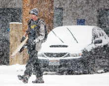
It's a nightmare for commuters and a blessing for skiers.
The so-called "lake effect" can enhance storms and dump deep snow on areas downwind of the Great Salt Lake. But it's difficult to forecast.
The phenomenon occurs when cold winter winds stream across the relatively warm waters of the Great Salt Lake, according to Jim Steenburgh, chairman of the Department of Atmospheric Sciences at the University of Utah.
In an exceptional year, lake effect can be responsible for up to 20 percent of snowfall in Big and Little Cottonwood canyons, he said. That's the equivalent of 100 inches at Alta.
With the help of a $471,000 grant from the National Science Foundation, Steenburgh and a team of students have launched a study aimed at more accurately predicting lake-effect storms.
Often, all the ingredients for lake effect seem to be in place, but it doesn't kick in, Steenburgh said.
The events occur more at night and seem to fall apart after sunrise, he noted. Generally, lake effect is established when land surrounding the lake cools while the lake water remains relatively warm. That forces an updraft over the water. Add an upper-level disturbance and voilà — maybe.
"Moist breezes come together over the lake and rise, forming bands of precipitation," Steenburgh said. "Sometimes we get elongated bands [of moisture], but sometimes we don't. And we don't know why."
The lake effect is strongest in late fall and early spring, Steenburgh said. December and January, generally, are not good months for producing lake-effect snow.
Steenburgh's project includes radar-based climatology as well as data gathered by weather balloons that is then loaded into computer models.
Researchers will also try to determine how much lake effect contributes to snowfall in areas downwind from the Great Salt Lake, especially Tooele Valley, Salt Lake Valley and the Wasatch Mountains. "The ultimate goal is to provide better information for people who clear the roads," Steenburgh said.
It could help water managers, as well.
But he concedes there is more to it than that. "I tell people I have a conflict of interest, because I like to ski so much."
This winter, Steenburgh's team will track seven storms as they cross the lake. To do that, they will launch weather balloons that will record temperatures, wind currents and precipitation as the storm systems move onto the lake and then dump snow as they move back over land.
Kristen Yeager, who is pursuing a master's degree in atmospheric science, was among the team that launched balloons from the north end of the Great Salt Lake as a storm moved in during the late hours of Nov. 8 and early hours of Nov. 9.
She and a colleague launched six balloons at three-hour intervals from the ghost town of Kelton. They gathered the data on laptop computers rigged to an antenna on the car that received signals from the balloon.
"It's definitely going to improve forecasts. That's the No. 1 thing," Yeager said. "But it also will give a more accurate picture of the lake effect."
Yeager is a native of central New York state, another locale affected by lake-effect storms. As a youngster, she developed an interest in lake effect and sought out the University of Utah to study it.
"One of the top reasons to go to the U. is the ability to go into the field," she said. "You don't get that at every school."
Steenburgh collaborates with Neil Laird at Hobart & William Smith Colleges in Geneva, N.Y., downwind from the Great Lakes.
He also works with Larry Dunn, the meteorologist in charge at the National Weather Service in Salt Lake City.
If Steenburgh's project is successful "it would be very significant," Dunn said. "It would be huge. Right now we have trouble predicting lake effect.
"Sometimes the contribution of the lake effect is obvious," Dunn noted. But it's not always easy to separate lake-effect snow from that of a storm that barrelled in from the Northwest.
Last year, Steenburgh and doctoral candidate Trevor Alcott developed computer models to predict the density of snow. It enables forecasters to predict how much snow will fall per inch of water in a storm. That model already is in use at the National Weather Service.
Alcott also is involved in this year's project.
"All this stuff will come together to make better forecasts," Steenburgh said. "In 10 years, weather forecasters will have computer models that will forecast lake effect. And you will see it on your TV before it happens."