


This is an archived article that was published on sltrib.com in 2016, and information in the article may be outdated. It is provided only for personal research purposes and may not be reprinted.
A planning process underway for a popular section of southern Utah's San Rafael Swell could lead to something akin to a national monument, except the state and Emery County would help call the shots and possibly collect recreation fees.
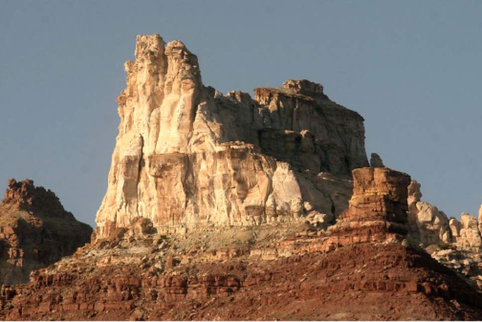
The Bureau of Land Management has initiated an environmental review to develop a recreation-management plan for the Temple Mountain area encircling Goblin Valley State Park, a 200,000-acre "recreation management zone" that has become swamped by outdoor activities of all types in recent years.
The agency needs to start guiding recreational use before the impacts become unmanageable, according to Ahmed Mohsen, the BLM's Price field office manager.
"It is receiving a lot of visitor use, from primitive recreation to fully motorized and RVs," he said.
At Temple Mountain, located 100 miles from the BLM's office in Price, Mohsen is pursuing a program modeled after the BLM's partnership with Grand County to administer the Sand Flats Recreation Area, where the county collects fees on myriad activities playing out on public land outside Moab.
In this case, the Utah Division of State Parks and Recreation would play a lead role because of its strong presence at Goblin Valley.
"There are some things State Parks does well and we do other things well; we want to join together to do what we do best cooperatively," Mohsen said.
But wilderness activists remain skeptical, concerned about the potential for commercialization and over-development that could degrade the landscape, which is rich in rock art and geological mystery.
"The BLM must drop its plans for cooperative management and meet its obligation to develop a recreation management plan for the entire San Rafael Swell [special recreation management area] without undue influence from anti-conservation, pro-motorized development interests at the state and county level," attorney Neal Clark posted Thursday in an alert to members of the Southern Utah Wilderness Alliance.
Yet there is broad agreement that more must be done to channel various recreational users to designated areas.
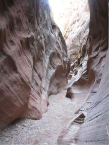
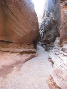
Crowded out of Utah's "Mighty Five" national parks, Coloradoans and Utahns are increasingly turning to southern Utah's publicly owned redrock landscapes that are equally alluring but are without the tour buses, entrance fees and convenient restrooms. The fragile desert around the San Rafael Reef, marking the southeast margins of the swell, is getting hammered by campers, hikers and motorized travelers. The BLM currently maintains several miles of motorized routes, bike trails, two developed group campsites, restrooms at three locations and 10 trailheads. Most camping is dispersed and its footprint is constantly growing.
"Impacts on the land have likewise gone up with new user-created trails and campsites. After every big weekend there is more denuded lands out there," said Tim Smith, southeast regional director for State Parks. "I'm not saying we could do a better job than the feds, it's a question of proximity. If we could charge user fees we could create several new jobs, take better care of the land and put in a few amenities, like picnic tables and restrooms."
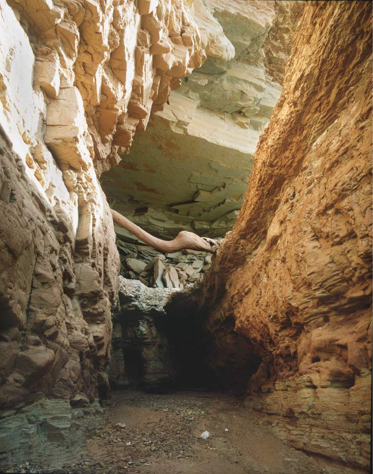
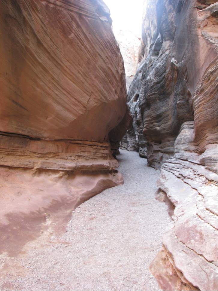
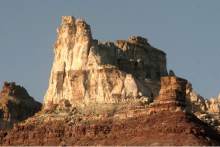
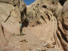
An environmental assessment on this area — characterized by narrow canyons, towering mesas and otherworldly folded sandstone features — will produce a range of options, from doing nothing to an aggressive development scenario. The final plan would likely establish areas for certain uses, like camping and bike riding, as well as picnic facilities, trailheads and other amenities.
Members of the public can submit comments on the kind of management priorities they would like to see pursued for these public lands.
The plan is an outgrowth of a proposal State Parks floated in 2014 to greatly expand Goblin Valley State Park by incorporating 132,000 surrounding acres of federal land into one its most profitable parks.
Goblin Valley visitation has more than tripled to 191,000 since 2011, and federal land managers figure use on the adjacent lands has skyrocketed accordingly.
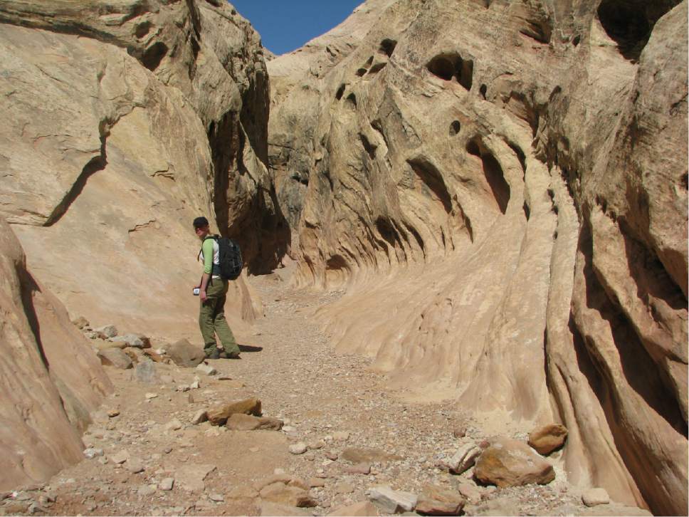
On a recent Tuesday, Mohsen noted that vehicles were spilling out of the parking area for the Little Wild Horse trailhead, which serves the swell's most popular hike. On busy days, the famed slot canyon becomes so clogged with hikers that they can't get around each other as they negotiate tight passages.
Emery County officials hope the planning outcome resembles what is proposed for this area in Rep. Rob Bishop's Public Lands Initiative, or PLI, the bill he introduced last summer aimed at resolving land-use battles on 18 million federal acres in seven eastern Utah counties.
A few pages of the bill describe a 152,278-acre "cooperative management area," but specify few details on how these lands would be managed beyond saying the purpose would be "to promote outdoor recreation, such as off-highway vehicle use, mountain biking, rock climbing, and hiking." Some wilderness would be designated and 10,000 federal acres would be conveyed to the state. That is nearly three times the current size of the 3,011-acre state park.
"Everybody says this is a good idea," said Ray Peterson, Emery County's economic development director. "There is trepidation that it will cost me a fee. Maybe it will, but the fee would be there to manage the resources."
The county does not see much revenue from all this traffic, so officials hope coordinated management of recreation could help get visitors to hang around for a meal or an overnight stay in one of the nearby towns.
"But if we don't get the management we won't have the resource. We are behind already," Peterson said.
Under an agreement reached with BLM last April, State Parks and Emery County will help craft a plan, select a third-party contractor, and even kick in $100,000. A Salt Lake City consultant, SWCA, has been hired to coordinate the environmental assessment.
The agreement acknowledges "the importance of maintaining the intrinsic qualities of the area and the need to manage recreational use in a safe and sustainable manner." But Clark is skeptical of the intentions of State Parks, which has adopted a market-driven approach to parks management in recent years, resulting in more and more recreational amenities like bike and motorized trails, yurts and even zip lines.
The planning area includes 169,000 BLM acres and 22,000 acres of state trust lands, some of it included in wilderness study areas where motorized use is prohibited. The planning area is bound by State Route 24 on the east, the Wayne County line on the south and Big Ridge on the west, and bisected by the Crack Canyon Wilderness Study Area, home to some of the swell's most popular hikes, such as Little Wild Horse, Crack, Chute and Ding and Dang canyons.
No resource extraction occurs in this area, but it was once a busy place for uranium mining and supplied Marie Curie's lab for her early experiments into radioactivity. According to local legend, the Nobel laureate visited Temple Mountain during one of her trips to the United States in the early 1900s to check out the source of her high-grade ore.
The BLM was supposed to have completed a management plan for the larger San Rafael Swell four years ago, but the task has proven too daunting to knock out in one bite.
"This piecemeal approach to satisfy the desires of the state is a bizarre way to go about it," Clark said.
Some of Clark's reservations about the state plan come down to the different philosophies of State Parks and the BLM, which he said is obligated to manage land "for the greater good for the American people."
State Parks' commitment of $100,000 shows that the state expects to "have some influence in how this place gets developed," Clark said. "It speaks to a plan to develop amenities and create fees."
Brian Maffly covers public lands for The Salt Lake Tribune. Brian Maffly can be reached at bmaffly@sltrib.com or 801-257-8713. Twitter: @brianmaffly