


This is an archived article that was published on sltrib.com in 2012, and information in the article may be outdated. It is provided only for personal research purposes and may not be reprinted.
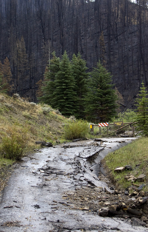
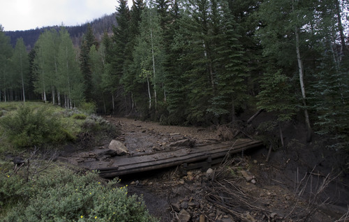
Huntington • Old Folks Flat Campground normally would be buzzing with hikers lacing up their boots and barbecuing burgers.
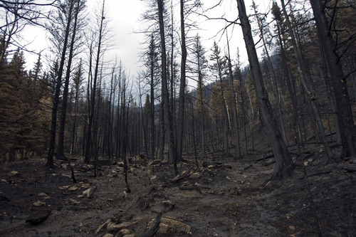
Instead, prairie dogs have the run of the place, ever since the U.S. Forest Service gated off the wildfire-scarred area.
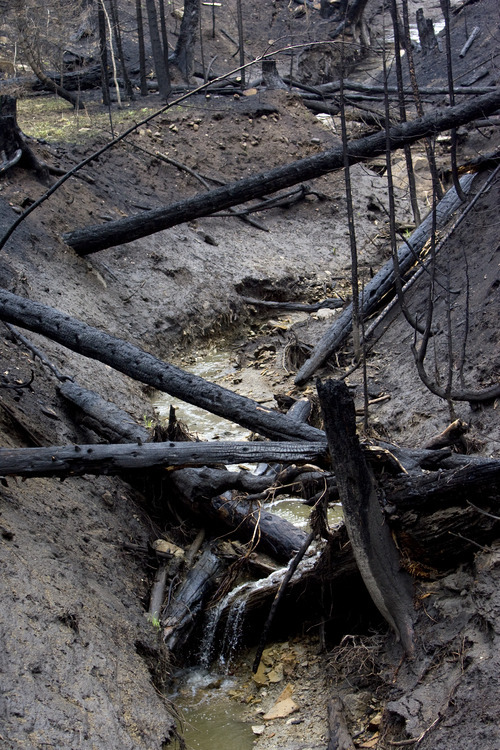
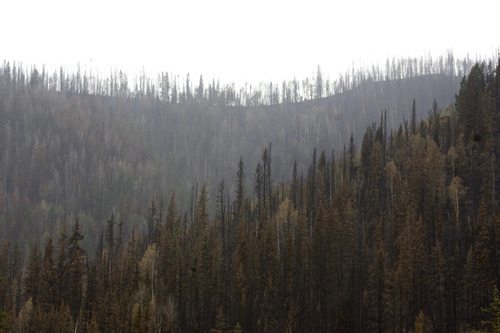
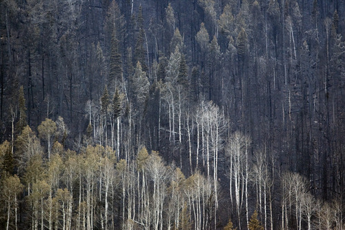
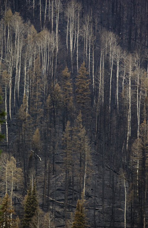
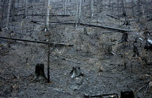
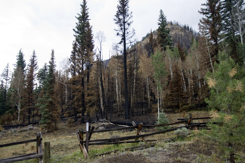
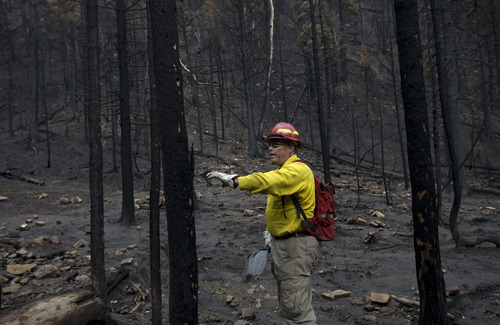
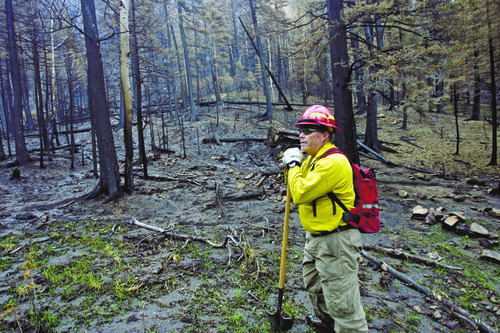
The flames might be gone, but danger remains at the popular central Utah getaway. So says Brian McInerney, a hydrologist with the National Weather Service. As he gazes up a slick and charred hillside, he sees a mountain landscape ready to melt into a mudslide.
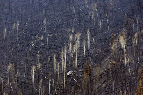
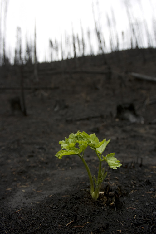
Four days earlier, the Seeley Fire had destroyed the green glue — the vegetation and roots — that holds together the forested slope. A downpour anytime in the next three years could drag the hillside into the campground and through tent sites, rustic latrines and gathering spots.
"That's really why we're here," says McInerney, the scent of doused campfire surrounding him and seemingly everything else within the 48,000 acres burned in Huntington Canyon. "We want to warn [of] these big, scary events."
Such warnings demonstrate a new dimension of teamwork between the weather service and other agencies in forecasting mudslides on torched terrain.
The idea is to look at burned wildlands as well as the so-called "urban-wild-land interface" — residential patches on the edge of forests and ranges such as the fringe of suburban Alpine, where the recent Quail Fire devoured 2,222 acres.
The forecasts are also part of a wider effort by the National Oceanic and Atmospheric Administration, the weather service's parent agency, to put its scientists and weather-tracking instruments to use providing practical, weather-related information — meteorological news you can use, if you will.
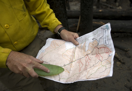
John Chatel leads a Forest Service team that focuses on restoring big burn areas, and McInerney has been invited to work with his specialized group on the Seeley Fire.
This Burned Area Emergency Response (BAER) team works like a disaster-cleanup unit that rehabilitates areas scorched by fires, assesses immediate threats to high-value forest resources and suggests options for restoring areas over the long run.
"An intensity map," Chatel says, spelling out an assessment of the Seeley Fire, "helps us prioritize where you are going to look" for potential hazards.
McInerney, who fought fires including the infamous Yellowstone infernos of 1988, has traipsed the burned area here side by side with recreation specialists, soil experts, engineers and other BAER team members. They zero in on the intensity, severity and steepness of high-priority areas.
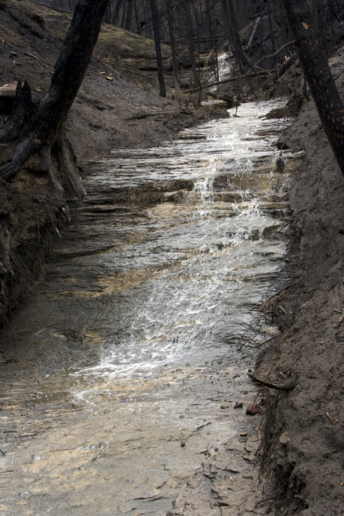
They also run tests. Water checks, for instance, help measure the soil's capacity to hold and shed water that falls on it.
Back in his Salt Lake City office, McInerney takes the information, runs it through a computer and produces a slide forecast. With it, he hopes to be able to warn the public, federal agencies and local preparedness officials before a serious storm threatens to trigger a mudslide.
The process is part science, part art.
"You don't want to over-forecast and you don't want to under-forecast, either," McInerney says. "If you miss, people can die in these things."
So, at the scar left by the Quail Fire in Alpine, for instance, he is now able to watch a rainstorm rolling toward the area and determine if it's likely to cause a slide or debris flow.
A forecast like that can give people lifesaving time they need to get out of harm's way.
"Get the kids in the car and go for ice cream, and don't let your kids sleep in the basement," he offers as a simple strategy for homeowners in areas made vulnerable by fire. "You can always replace your stuff, but you can't replace your family."
It turns out, Seeley Fire mudslides could have significant economic impact — beyond the safety concerns.
Not only do irrigators depend on fresh river water that runs through the canyon, but the 996-megawatt Huntington Power Plant also relies on it for cooling tower water. If the stream clogs with debris or is clouded by mud, PacifiCorp has to tap into its reserve water supply to keep operations on track.
Safety at the popular Huntington Canyon campgrounds is also a worry. Manti-La Sal National Forest officials closed all the campgrounds in the canyon on June 26.
The possibility of more slides here seems obvious to McInerney and others. There already have been five, including one captured on YouTube that swept across State Road 31 on July 7.
"We will wait to see what information the BAER team brings back to us to help us make that decision to reopen the campgrounds," says Rosann Fillmore, of the Forest Service's Price office. "We will not open campgrounds until it is safe for the public to use them."
McInerney says it could take three years for the charred hillsides in the Manti-La Sal to be safe from mudslides.
He wrapped up his work at the Seeley Fire on Monday. By week's end, he'll be out looking at more fire scars in central Utah.
Twitter: @judyfutah —
For more photos and video
To see more photos of the burned areas from the Seeley Fire, along with a YouTube video of July 7 slide, go to http://www.sltrib.com.