


This is an archived article that was published on sltrib.com in 2013, and information in the article may be outdated. It is provided only for personal research purposes and may not be reprinted.
Grandeur Peak
Getting there • From Salt Lake City take I-80 east to I-215 south and take the 3900 South exit. Make your first left onto Wasatch Boulevard and follow it to about 3800 South, and look for signs pointing you toward Mill Creek Canyon and Church Fork picnic area. Make a right into the canyon and follow that road into the park for about 3 miles. You can park along the main road at the base of the picnic area and climb up to the trail head, or you can try to drive and find a spot in the very small parking lot at the Gradeur Peak trail head. Drive past the picnic tables until you reach a dead end by a waterfall. Be careful as you ascend — the road is not quite big enough for two cars, and its twists and turns can make it difficult to see oncoming traffic.
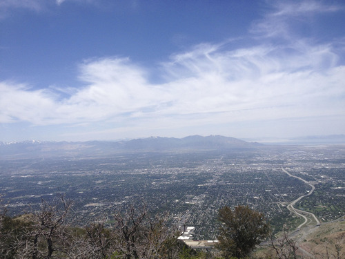
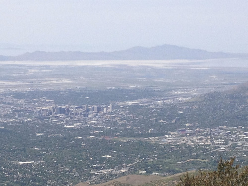
Directions • At the top of Grandeur Peak, hikers from of varying ages, abilities and walks of life pause for a moment to take in the beauty of the Salt Lake Valley. Silhouettes of neighboring mountains frame the glimmering skyline of Salt Lake City and the sprawl of the valley. As new arrivals ascend the summit, these hikers smile and call out congratulations. There is a feeling at 8,299 feet of unity and solidarity. And there's nothing quite like eating lunch with the world at your feet and new friends by your side.
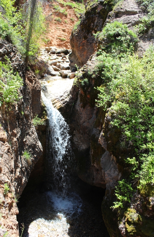
The feeling is rooted in an understanding that the climb to the summit of Grandeur Peak is challenging. But there are rewards nearly every step of the way. It begins at the trail head, where a rush of cool water welcomes you to the small falls beneath the trail. Ascend a small slope to a footbridge over the falls and continue on the trail until you reach a weathered mileage sign. The sign will show you that you can take a trail to the right, which is part of the Pipeline Trail, or continue on toward the peak.
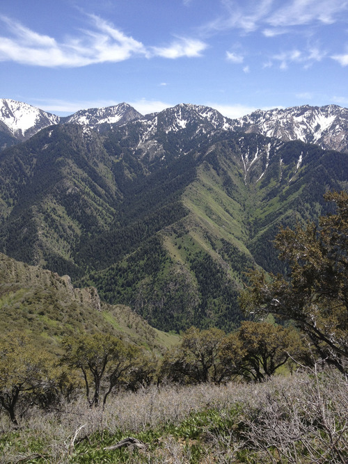
The trek through the aspens and pines that line the early stretch of the trail is a good indicator of what's to come. It's beautiful, but can be challenging. The trees shield hikers from the sun. Enjoy it. Higher up, the trail is much more exposed. The air gets hotter and the terrain rougher.
The climb to the saddle takes you over switchbacks and it can be hard to tell which paths are the trail and which are hiker-created shortcuts. Look for branches and other items blocking paths. If it looks like it's in your way, it probably is. Take the path of least resistance.
Once you reach the saddle, look around. The view of the Salt Lake Valley is incredible. From here to the top, it's steep climb to the top, around the front of the mountain.
After you've had your fill of the view from the top, the hike back down is much easier and will go much faster than it did coming up. As you pass winded hikers climbing toward the summit, smile. They're almost there.
Marissa Lang Grandeur Peak
Hiking time 4 hours 30 minutes
Round-trip miles 6.5 miles
Elevation gain 1,699 feet
Difficulty Moderate/Difficult
Trailhead restrooms Yes, in picnic area
Dogs allowed Yes
Bikes allowed Not recommended