


This is an archived article that was published on sltrib.com in 2011, and information in the article may be outdated. It is provided only for personal research purposes and may not be reprinted.
Directions • From Moroni, turn west on State Road 116. Follow it for 2.7 miles to West Side Road. Go north for 1.3 miles and turn west on Freedom Road. Signs should direct you to Maple Canyon, about 2.5 miles away. Drive into the canyon and find the Forest Service campground. The trail head is at the entrance to the campground.
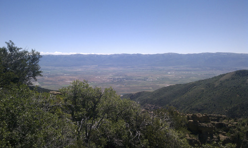
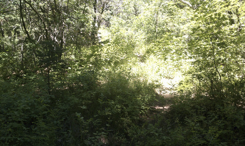
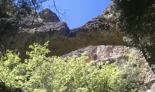
The foliage makes this a great summertime or fall hike. The trail also includes an arch and a good view of Sanpete County. The loop is composed of the Middle Fork and Right Fork trails. From the trailhead, the hike begins on the Middle Fork. After about a half a mile, a sign directs you a few yards off the main trail to an arch cut out of conglomerate rock. Back on the trail, watch for a sign pointing to the Right Fork. Follow it to a bench where you can sit at the overlook. From there it's downhill for the return to the campground.
—
Maple Canyon Loop Trail (Sanpete County)
Destination •Loop
Hiking time • 2 hours
Round trip miles • 2.5 miles
Elevation gain • 1,218 feet
Difficulty • Moderate
Trail head restrooms • Yes
Dogs allowed • Yes
Bikes allowed • No
Fees • $3 Destination Loop
Hiking time 2 hours
Round trip miles 2.5 miles
Elevation gain 1,218 feet
Difficulty Moderate
Trailhead restrooms Yes
Dogs allowed Yes
Bikes allowed No
Fees $3