This is an archived article that was published on sltrib.com in 2016, and information in the article may be outdated. It is provided only for personal research purposes and may not be reprinted.
Beaver Dam • When Interstate 15 was completed through the Virgin River Gorge, old Highway 191 over Utah Hill that once provided the main route from Utah to southern California became a lonely desert highway.
That highway now is the only pavement that runs through the ecologically unique 63,500-acre Beaver Dam Wash National Conservation Area in extreme southwestern Utah.
Congress created the area in 2009 "to conserve, protect and enhance the ecological, scenic, wildlife, recreational, cultural, historical, natural, educational and scientific resources" of these public lands.
The area interests ecologists because three distinctive geographic zones — the Mojave Desert, Great Basin and Colorado Plateau — join in a place where water and visitors are scarce, but desert diversity can be seen everywhere.
"Ecologically and geologically, it is very important," said Ken Packer, who manages the historic 462-acre Lytle Ranch located in the middle of public lands for BYU. "Three different ecosystems come together. There is a bird flyway from north and south and, because there is water there, there are a lot of different bird species that come through there."
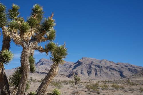
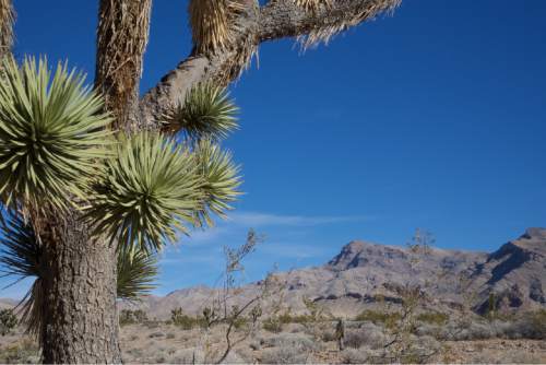
This is a wild place with a few dirt roads and plenty of room to roam. Creosote bush, white bursage and other desert shrubs grow at lower elevations, providing habitat for desert bighorn sheep and the threatened Mojave desert tortoise. Joshua Trees and dense stands of blackbrush cover the slopes of the Beaver Dam Mountains.
The Bureau of Land Management offers visitors no developed recreation facilities currently, though it is preparing a management plan to address those uses and the types of facilities that might be needed in the future.
Congress restricted all motorized vehicle travel including off-highway vehicles, to designated roads.
Those who explore the area via dirt roads can enjoy often-lonely vistas, starlit nights and chances to see all sorts of birds and mammals.
One of the most interesting dirt-road drives is on the Joshua Tree Road Scenic Byway, located just west of Littlefield, Ariz., on the western slopes of the Beaver Dam Mountains.
The road and the 1,015-acre Joshua Tree National Landmark, was established in 1966, but the area is now part of the larger national conservation area.
According to the BLM, the area was given national landmark status because of Joshua tree forest in the area, the only one in Utah and one of the northernmost stands of tree yuccas in the United States.
Though wildfires in 1993 and 2006 destroyed some of the trees, they are still evident along the Scenic Backway.
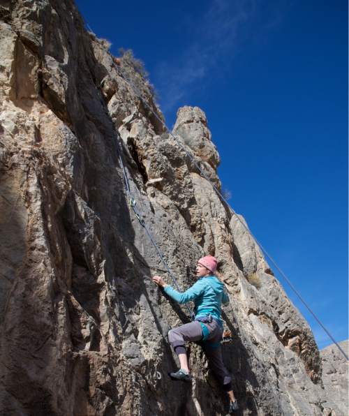
That's where Colorado climbers Katy Pappin and Kevin Dunkak discovered a limestone cliff mentioned in the Limestone Bible climbing book and decided to park their camper van in the area and do some climbing.
"We didn't even hear a coyote," Pappin said about the desert experience.
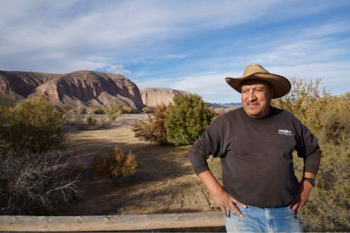
The Lytle Ranch offers as close to any kind of camping facilities as can be found in the area. Caretaker Heriberto Madrigal greets visitors to the area.
Packer said the private ranch, which is popular with birders because there is usually water in the wash that draws birds to the area, is open for day use visitors. Those who want to camp should call the Monte L. Bean Museum at BYU at 801-422-5052 to see if spots are available. The ranch also has a bunkhouse, which is used primarily for groups studying the ecology.
According to Packer, there are many of those at what is essentially a desert ecology research station. Researchers from all over the world, including a group from Germany, come to do long-term studies on plants, soils, mammals and birds that use the area.
"One of the things I like about it is the fact that we can get the kids out of university laboratories and get them down here and have them camp out or stay in the bunkhouse and get them exposed to nature's laboratory," he said. "You have got to see nature in context or you just don't understand it. Watching a rainstorm come through in the middle of summer and smelling the desert is an experience that everybody needs."
According to the Washington County Historical Society, the Lytle Ranch was originally settled by Mormon pioneers Dudley and Mary Leavitt sometime in the 1870s. The ranch is named after Talmage and Elanor Marie Lytle, who purchased it from the Eardley family in 1952.
The area was purchased by The Nature Conservancy in August of 1985 and sold to BYU in 1986. The original Lytle home was demolished in 2010 after floods damaged it beyond repair.
At an elevation of around 2,000 feet, the Beaver Dam Wash area also is Utah's lowest area.
In a state such as Utah that features the spectacular red rock of the Colorado Plateau, the alpine splendor of the Wasatch Mountains, and the open vistas of the Great Basin, this small corner offers a look at even more diversity with its own distinctive feel.
wharton@sltrib.com Twitter: @TribTomWharton —
About the Beaver Dam Wash National Conservation Area
• Created in 2009 by Congress.
• The NCA is located in the southwest corner of Washington County, approximately 22 miles west of St. George and roughly 13 miles northwest of Littlefield, Arizona. The Nevada and Arizona state lines border the western section and Interstate 15 and the Virgin River parallel its southern boundary. U.S. Highway 91 is the only paved highway through the NCA.
• The area, managed by the Bureau of Land Management, has no formal recreational facilities, though the Lytle Ranch, managed by BYU, has some camping and bunkhouse facilities.
• For information on the Beaver Dam National Conservation Area, log on to http://www.blm.gov/ut/st/en/fo/st__george.html.


