This is an archived article that was published on sltrib.com in 2016, and information in the article may be outdated. It is provided only for personal research purposes and may not be reprinted.
In a chant echoing from the mists of time, the Navajo embraced the kind of storms ushering in Utah's new work week as "the voice above, the voice of thunder."
For much of the state on Monday, as the "Twelfth Song of Thunder" describes, rain-, and sometimes hail-laden thunderstorms growled and snapped "within the dark cloud; again and again it sounds, the voice that beautifies the land."
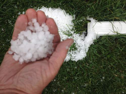
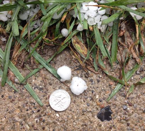
Heavy rain in the early and midafternoon on Monday brought hail to large parts of the Salt Lake Valley and caused a number of roadways to flood.
People in the western part of Salt Lake County saw hail as large as golf balls. National Weather Service meteorologist Monica Traphagan said the largest hail fell in Kearns, though parts of West Valley City experienced quarter-size hail.
The storm then moved east to Murry and Midvale, where it dumped heavy rain as well as some hail.
Traphagan says the weather service has only recorded 14 instances of hail that was the size of a ping-pong ball or greater in Salt Lake County. Authorities were dealing with multiple reports of flooding.
The Utah Department of Transportation specifically reported flooding on State Street near 7800 South, and standing water was reported on Interstate 15 near 7200 South.
Come Tuesday, though, warmer, drier and breezy conditions will return to the region. Those breezes will build in power by Wednesday, even as the mercury once more soars.
Tuesday's high temperatures along the Wasatch Front will climb into the upper-80s, up about 10 degrees from Monday's forecast. On Wednesday, the Salt Lake and Tooele valleys will hover around 90 degrees; winds of 20-30 mph early on will calm to 10-20 mph by nightfall.
Southern Utahns, too, began the week with isolated showers and thunderstorms, but Monday's highs still were forecast around 90 degrees, cooled somewhat by breezes of 10-20 mph. Tuesday's highs, under clear, sunny skies, were to climb into the mid-90s throughout Utah's Dixie, the same temperature range expected on Wednesday.
The Utah Division of Air Quality graded most areas of the state as "green," or healthy, but Salt Lake and Utah counties remain at "yellow," or moderate for particulate pollution into the midweek.
The Intermountain Allergy & Asthma website reported that grass and mold came in "high" on its pollen index as of Monday, while oak was "moderate.:
For more extensive forecast information, visit The Salt Lake Tribune's weather page at: http//www.sltrib.com/weather/.
(To read all of the "Twelfth Song of Thunder" visit http://www.eduplace.com/ss/hmss/3/unit/act2.1blm.html)
—The Associated Press contributed to this story.
Twitter: @remims


