


This is an archived article that was published on sltrib.com in 2017, and information in the article may be outdated. It is provided only for personal research purposes and may not be reprinted.
High on the Cedar Mesa, on the wedge of sandstone that hovers between White and Armstrong canyons, Natural Bridges National Monument appears to have been frozen for a season.
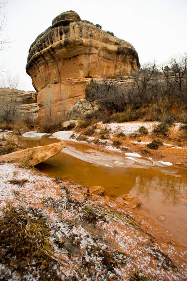
A blanket of snow settles on Deer Flat to the northeast. A windless January sky hangs gray and pregnant overhead. In the flat light, Sipapu Bridge — the second-largest natural bridge in the world — is barely visible, camouflaged amid bulky stacks of dense rock layers. No birds are singing. There are no other visitors. In contrast to reports of clogged parking lots and overwhelmed facilities at Zion National Park, these trailheads are empty.
But stillness is winter's lie at Natural Bridges.
Just beneath the rim of the canyon, everything is in motion.
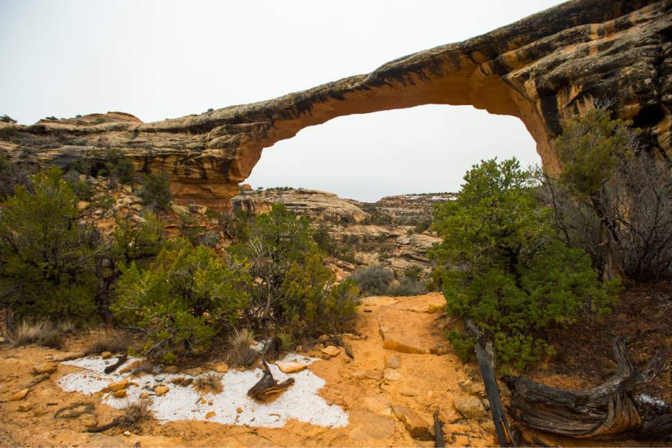
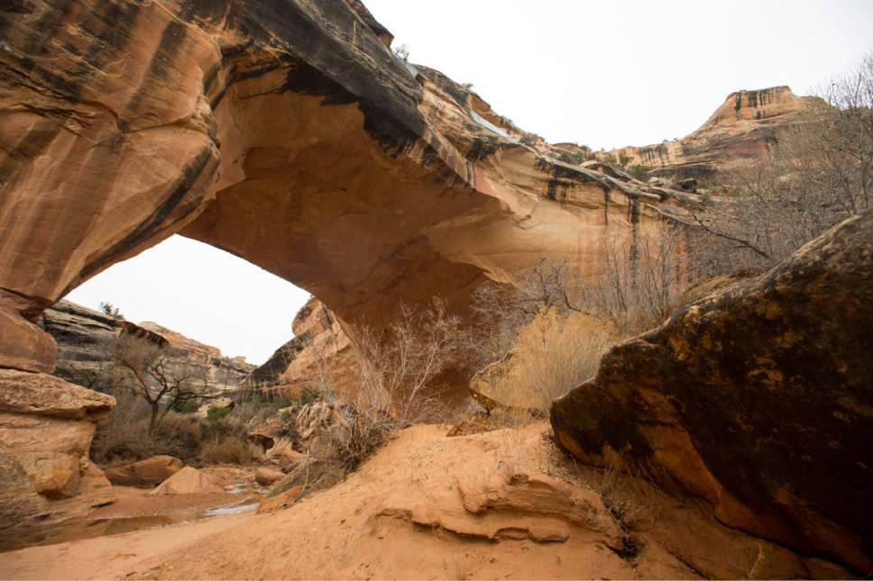
The first of several minor, temporary waterfalls appears just below Owachomo Bridge, dribbling off an alcove near the beginning of the loop hike through Owachomo and Kachina bridges. This is my winter version of the Natural Bridges Loop Trail, a hike I would rank easily among Utah's very best. I decided to skip the leg to Sipapu Bridge, whose name — Hopi for "souls' gateway to the spirit world" — seemed an adequate warning after rangers told me of ice on the steep slickrock and ladders nearby.
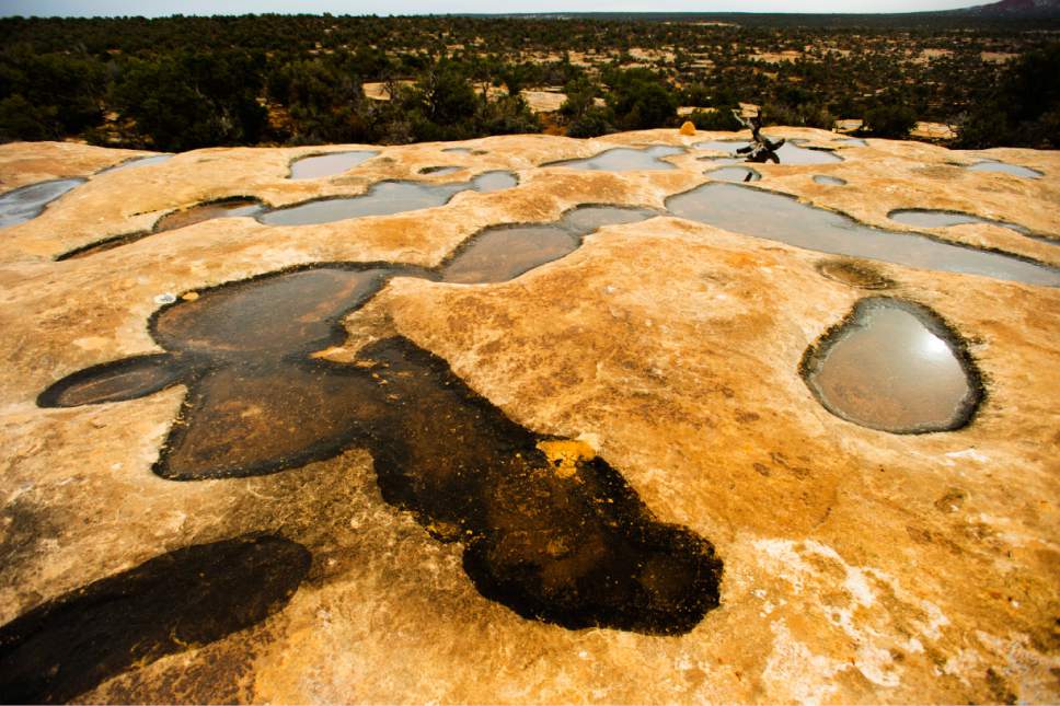
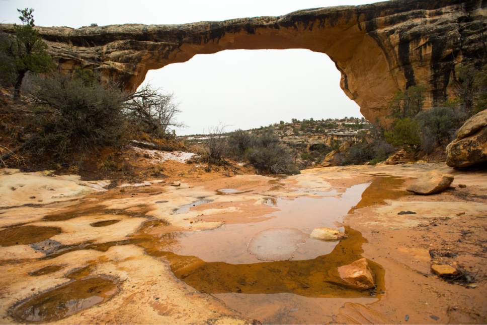
Owachomo Bridge, the thinnest of the three in the monument, reflects in the standing water inside potholes that lead to its base like inverted skipping stones. As Salt Lake Tribune photographer Rick Egan and I descend below the bridge, I hear water moving over the canyon floor and see it pooling at bottlenecks.
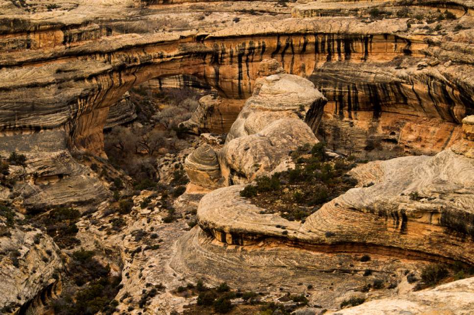
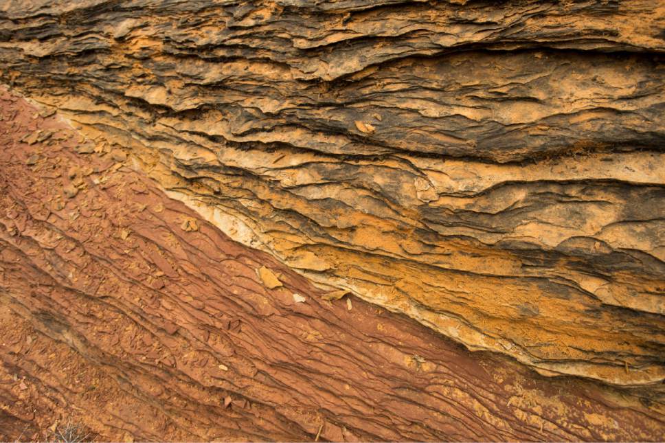
This is the action that made the bridges, long ago and at a larger scale. Rivers of glacial melt and rain from Utah's wetter days wove their way into the sandstone, creating vertical planes of rock. Floods bashed their way through, carving out a space the Paiute called "under the horse's belly."
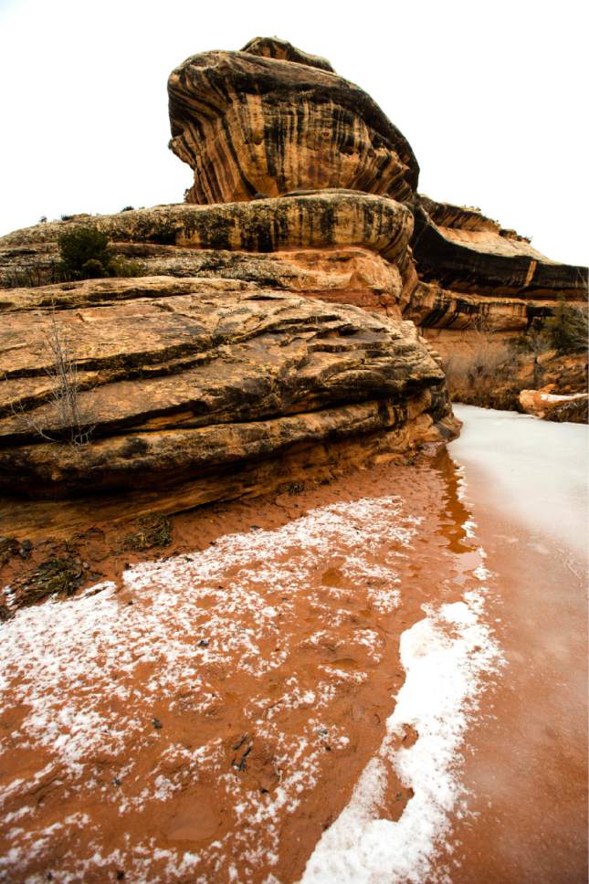
Farther down the canyon, two sheets of ice, big as ping pong tables and inches thick, have lurched up against each other. In a deeper section of stream, a thawing layer fades, inch by inch, from bright white to gray slush to black water. High above, the snow from last night's storm sinks into a translucent silver as it melts and seeps down the canyon walls, spattering and spilling over orange and tan ledges.
As Rick and I trudge over the muddy mesa back to my car, animal tracks appear in the soft soil. When we enter a clearing, a fox sprints across our path.
These aren't things you often can see in summer, when water arrives violently in torrents and evaporates immediately, leaving a hard crust of clay for visitors to share.
For more than six miles on the trail in winter, not another hiker crossed our path. And yet it is hard to imagine a better time to visit.
ealberty@sltrib.com
Twitter: @erinalberty Owachomo-Kachina Bridges Loop Hike
The hike begins at the trailhead for Owachomo Bridge. From the Natural Bridges Visitors Center, take the main Natural Bridges road west a half mile, where it branches into a one-way loop road. Turn north and follow that loop 6.25 miles to the Owachomo Bridge parking area, passing the trailheads for Sipapu and Kachina bridges on the way. Admission is $10 per vehicle.
Trail Description
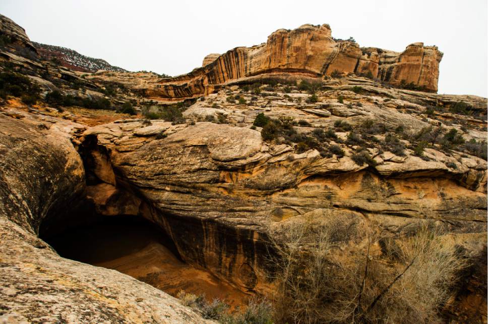
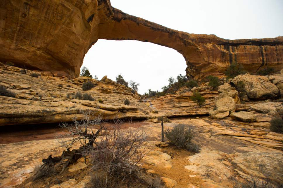
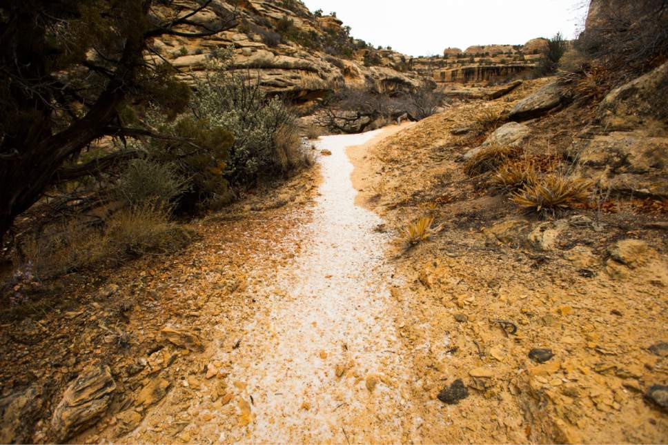
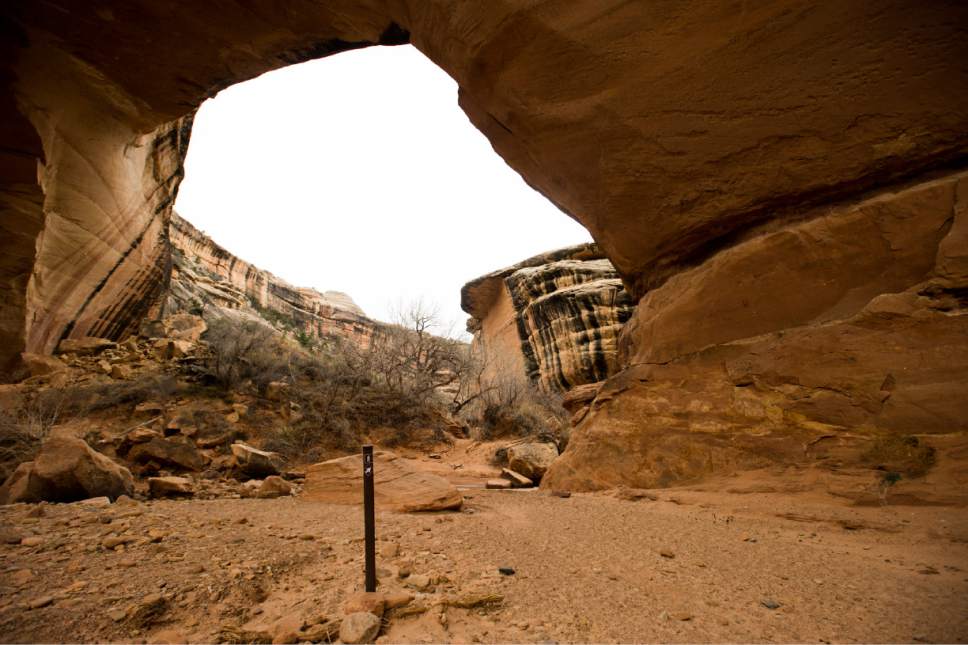
From the Owachomo Bridge trailhead, hike south-southwest 0.3 mile to the bridge. Beyond the bridge, the trail winds west and north for 3 miles to the Kachina Bridge trail junction, bobbing over hills of slickrock and mud, and occasionally crossing the stream at the bottom of Armstrong Canyon. Look high on the canyon walls for interesting rock formations and an ancestral Puebloan ruin hidden on a ledge.
Just before the junction, the trail ascends to the top of an alcove overlooking a waterfall known as the Knickpoint pour-off. A tenth of a mile later, a sign and a flight of stairs point to Kachina Bridge, 0.3 mile north. After viewing the bridge, return to the junction and follow the signed trail northeast 0.4 mile up switchbacks to the parking area. Across the street the trail continues over a wooded plateau, one mile east to a trail junction and 1.2 mile south back to the Owachomo trailhead.