This is an archived article that was published on sltrib.com in 2011, and information in the article may be outdated. It is provided only for personal research purposes and may not be reprinted.
The potential for spring flooding along some streams and rivers in northern Utah is significant — as high as 90 percent probability on some waterways — but it's still not a sure thing.
Weather conditions during the remainder of April and May will determine the extent of flooding, according to Brian McInerney, hydrologist with the National Weather Service.
"If the weather remains cold and wet, flood potential will remain significant," McInerney said. "But if we could have a mild and dry spring, we could get out of this flood potential without a problem."
Snowpack in Utah's mountains averages 150 percent above normal, and soils are saturated. That is the result of a strong La Niña weather pattern that brought high precipitation levels to Utah beginning in October, with the exception of San Juan County, which is about normal.
The La Niña — relatively cold surface water temperatures in the equatorial Pacific — is now fading and should be gone by June or July.
Flood potential is extremely high on the Logan and Blacksmith Fork rivers in Cache County, and along the Weber River and Chalk Creek in Summit County.
The probability of flooding along City Creek in Salt Lake City and Emigration Creek in Salt Lake County is much smaller, according to Weather Service flood models based on 30 years of data. And, as of mid-April, the potential for flooding on Little Cottonwood Creek is low, McInerney said.
Hydrologic models that predict flood potential take into account myriad factors, including topography, elevation and snow density, among others. Based on those factors, computer-generated flood models show the mountains above Logan, for example, will release snow faster than those in Little Cottonwood Canyon. That's also true of the Uinta Mountains above Oakley compared with those above City Creek Canyon in Salt Lake City.
There is some risk of flooding along the Duchesne River near Myton in eastern Utah. But the chance of flooding along the Sevier River in central Utah and the Virgin and Santa Clara rivers in southern Utah's Washington County is rated as low.
McInerney cautioned that those potentials could change, depending on the weather.
Data over the past three decades reveal that big snow years, such as 2006, don't necessarily lead to flooding if April and May are mild enough to allow a gradual runoff, McInerney said.
By contrast, lackluster snow seasons, like the one that ended in spring 2010, can bring flooding. Last year, April and May were cool and wet. But on June 6, temperatures jumped, leading to flooding on the Weber River in and around Oakley in Summit County and along Little Cottonwood Creek in Salt Lake County, Sandy and Murray.
But even if April and May are average this year, flooding along the Logan and Weber rivers looks likely at this time, McInerney said.
Flood stage along the Logan River occurs when flows exceed 1,355 cubic feet per second. According to the weather service models, there is a 90 percent chance that the Logan River will exceed 1,440 cfs.
"In the most probable scenario, we are going to flood" along the Logan River, he said.
On the Weber River, flood stage occurs at 1,950 cfs. McInerney's calculations indicate a 90 percent chance that flows will go to 2,020 cfs. If so, the river would come out of its banks.
Oakley resident Matt Leavitt worries about the potential of flooding this year. In 2010, his home was damaged so badly that he and his family still haven't been able to move back. The living quarters of the structure suffered water damage, but strong currents also wrought havoc on the footings and foundation, making it uninhabitable, Leavitt said. He's still battling his insurance company.
"We'll try and do what we can," he said about bracing for the high water.
But along City Creek, which sits below snowpack that is 187 percent of normal, flooding is much less likely. Flooding occurs along City Creek when flows reach 210 cfs. But according to McInerney, there is only a 10 percent chance that the creek will reach 220 cfs.
Nonetheless, in some areas of Salt Lake City, officials say the ground is so saturated that basements could flood.
Officials in Cache, Summit and Salt Lake counties are preparing for flooding. In Cache and Summit, officials say they are aware of the models that indicate a 90 percent probability of flooding on the Logan and Weber rivers.
Cache County Emergency Director Rick Williams said his teams of emergency responders are stationing sandbags at strategic locations for use by residents and landowners.
"We're right in the heat of battle in terms of planning our efforts," he said. "We're taking it very serious, because after it starts, it's too late."
Among other things, Cache officials are coordinating efforts with emergency response teams, the Red Cross, the LDS Church and others.
In Summit County, Public Works Director Kevin Callahan said crews have filled sandbags for residents who need them. The county also will deliver sand and empty bags to residents who request them.
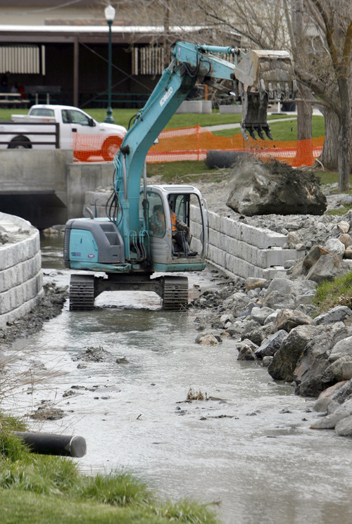
After last year's flooding along the Weber near Oakley, Summit County, with help from a federal grant, cleared the river channel of 100 tons of debris and is in the process of making bank improvements.
Salt Lake County, which is responsible for the Little Cottonwood Creek channel, has spent $2 million improving the banks along the waterway since the flooding in June, according to Scott Baird, the county's flood engineer. Those improvements include areas in Murray and Sandy.
csmart@sltrib.com See real-time stream flows. • http://www.cbrfc.noaa.gov —
For sandbagsand flood help
Cache County (unincorporated) • 435-755-1059
Summit County •435-336-3970
Salt Lake County(unincorporated) •801-468-2711
Murray • 801-270-2440
Salt Lake City •801-483-6700 ext. 1
Sandy • 801-352-4400 —
Flood watch north of I-80 begins Sunday
The National Weather Service on Saturday issued a flood watch for the state north of Interstate 80. The watch begins late Sunday and continues through Tuesday morning.
Rivers and streams in Cache and Weber counties are especially in danger, as is Emigration Creek in Salt Lake County. As much as ½ inch of precipitation is expected in lower elevations beginning late Sunday, and up to 1½ inches is expected in the mountains, the weather service said.


