


This is an archived article that was published on sltrib.com in 2011, and information in the article may be outdated. It is provided only for personal research purposes and may not be reprinted.
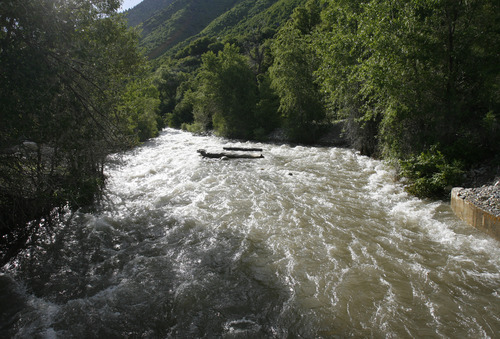
It's no longer a question of if Utah's hot weather and near-record snowpack will bring floodwaters gushing into the state's valleys — it's just exactly when, and how bad it will be.
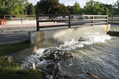
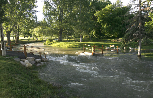
The National Weather Service on Thursday declared the long cat-and-mouse game with Mother Nature was just about over. Forecasters issued flood watches for most of northern and central Utah, even as the state's already swollen waterways began an inexorable rise past their banks and neared the tops of levees and sandbag barriers.
In Salt Lake County, public works crews were on alert at both Little and Big Cottonwood creeks. Little Cottonwood was expected to rise but remain below flood stage, 800 cubic feet per second (cfs), until just before midnight Friday. It is expected to peak about 1 a.m. Saturday at 920 cubic feet per second and should drop below flood stage by 3 a.m.
Big Cottonwood Creek is forecast to reach flood stage at 800 cfs Saturday at 1 a.m. It should retreat below flood stage within a two- to three-hour period.
The fast-moving, bank-full Jordan River and City and Mill creeks also warranted Salt Lake area floodwatchers' attention.
To the north, the Weber and Logan rivers were inching upward. The Weber, especially where it flows near the Summit County town of Oakley, was near flood stage (about 2,400 cfs) Thursday afternoon, heading toward 2,900 cfs by 4 a.m. Friday; the Logan River neared 1,700 cfs by mid-afternoon (well above the 1,400 cfs flood stage) and was forecast to top 1,800 cfs by 3:30 a.m. Friday.
In Utah County, the upper Provo River was on target to pass flood stage by 2 a.m. Friday, while eastern Utah's upper Duchesne River was rising toward flood stage, expected to top its banks by 7 p.m. Friday.
While temperatures Thursday rose into the low 90s in northern Utah, the mid-90s in the central part of the state and hit 107 degrees in St. George, a slight cooling trend Saturday was expected to drop the mercury by seven to 10 degrees.
With Thursday's high temperatures, gusty winds and desert rangelands and scrub forests tinder dry, a "red flag" fire warning was issued for a swatch of southern Utah extending from Escalante to the Arizona border and running west through the Zion National Park area and St. George.
Find more info online
O To Follow river and creek flows, visit this site.
> cbrfc.noaa.gov/gmap/gmap.php More on Utah floods.
> sltrib.com/topics/utflood