


This is an archived article that was published on sltrib.com in 2011, and information in the article may be outdated. It is provided only for personal research purposes and may not be reprinted.
Oakley • In the 57 years he has been coming to his family's cabin along the Weber River, Rob Taylor has seen the water this high only three times: in dramatic 1983, last year and now.
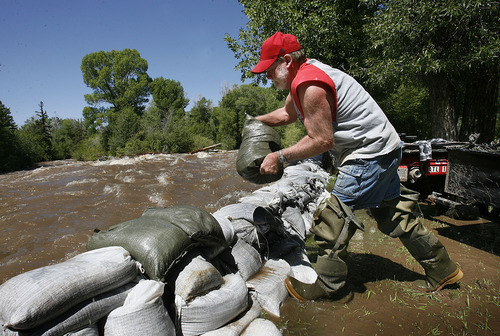
"Back to backers," he said, shaking his head in amazement Saturday morning as he surveyed the overnight damage to his sandbag dikes and framed a plan for dealing with the river's next major assault, between 1 a.m. and 2 a.m. Sunday.
"What blows my mind," added his wife, Brenda, "is the rapids."
The Taylor family has spent 15 years running rivers. Desolation Canyon, Cataract, the Yampa in Colorado. Now they can see white-capped rapids every bit as impressive as what those iconic rafting rivers have to offer — from their back yard.
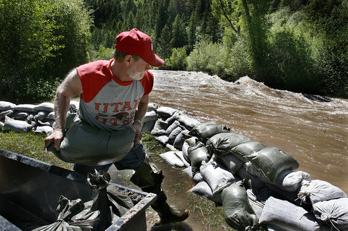
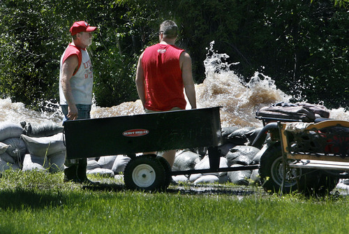
"This [year] is a really mean one," said Rob, 59, clad in a University of Utah hat and shirt, blue jean shorts and hip waders while adding a fifth level of sandbags to the wall separating him from the roiling rapids. "It just continued to snow in the Uintas into mid-June. There was no time for it to melt off."
For the second day in a row, lowlands along the Weber River sustained the state's worst flooding early Saturday after summertime temperatures the previous day flushed water out of the still deep snowpack. It would have been worse if not for a canal that is diverting a significant amount of runoff from the Weber into the Provo River drainage system, according to Brian McInerny, hydrologist for the National Weather Service in Salt Lake City.
Flows in Little Cottonwood Canyon exceeded flood stage Saturday morning. But other than the standard overflows in Murray Park, streamside properties escaped the high water largely unscathed.
Big Cottonwood Creek was even more well behaved, as were the Provo River, the Logan, and two outlying river basins, the Duchesne and Bear.
All were expected to keep running fast and full Saturday night before sliding back a little on Monday and Tuesday. Warmer midweek temperatures are projected to send many of those teeming waterways to their highest flows yet on Wednesday and Thursday.
The Taylors have been preparing for this possibility for six weeks. The Draper residents — he's a letter carrier, she's a quality analyst — started filling sandbags the first week of May. By Rob's estimation, they have put about 2,500 of them in a semicircle around the rustic cabin his dad and grandpa built when he was 2.
But the Taylors' biggest challenge Saturday came from runoff that flowed down onto their land from behind the three-bag wide, four-bag high dike.
This steady flow had escaped the main river channel at a campground a little higher up the canyon, creating its own channels as it surrounded two new homes just above the Taylor property. Ankle deep in places, the water flowed through Taylor's yard and then into his sister's yard downstream, sparking a sandbagging operation at that house too.
"We worked so hard," Brenda said. "And then it came through there. We just threw up our hands. There's nothing we can do to stop it."
But that didn't mean they weren't going to try. The Taylors, their son and daughter-in-law, and daughter and son-in-law, just started filling more sandbags, building the walls up even more.
And they were preparing to sleep in the back of their trucks Saturday night so they could rush to action if need be. It's all worth it, Brenda noted, when "you love your place so much."
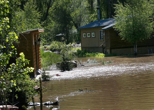
Not a mile downstream from the Taylors is the Pinion Lane neighborhood that bore the brunt of Friday's flooding along the Weber. About a dozen summer-home lots were victimized when a couple of fallen cottonwood branches temporarily diverted water out of the Weber and into yards.
Most of those residents have been fine since a Summit County backhoe pulled out the limbs just before noon Friday. Except Scott Quai.
The same kind of backwash at the Taylors was wreaking havoc on his property Saturday.
After he was flooded last year, Quai built a $4,500 earthen berm along his stretch of river channel. It did great. But so much water poured through the vegetation flanking the river that the pond around the Park City resident's summer home rose a good foot Saturday morning. The flow from under his shed came out in little ripples of whitewater.
"There's just a lot of water coming down," Quai said philosophically. "What it's like is the old Dutchman with his finger in the dike. It's just not enough."
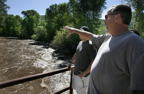
Higher in Weber Canyon, residents of the Beaver Springs development also were using sandbag dikes to divert newly formed river channels around sandbagged homes.
"We've been up here 30 years. I've never seen it like this," said John Ward, who surveyed the fast-moving water with his teen-age sons Jordan and Riley.
"If you're a property owner, what do you do? You watch it and clean up afterward," he said.
Stream flow forecast
Little Cottonwood Creek • Melt rate at headwaters: 3.3 inches per day. Flood stage: 800 cubic feet per second. Peak Sunday: 740 cfs. Three-day forecast: could reach 938 cfs by Tuesday.
Big Cottonwood Creek • Melt rate at headwaters: 2.6 inches per day. Flood stage: 800 cfs. Peak Sunday: 780 cfs. Three-day forecast: could reach 836 cfs by Tuesday.
Weber River near Oakley • Melt rate near headwaters: 2.6 inches per day. Flood stage: 2,590 cfs. Peak Sunday: 3,100 cfs. Three-day forecast: could reach 3,195 cfs by Tuesday.
Logan River • Melt rate at headwaters: 2.4 inches per day. Flood stage: 1,350 cfs. Peak Sunday: 1,600 cfs. Three-day forecast: could reach 1,822 cfs by Tuesday.
Source • National Weather Service