


This is an archived article that was published on sltrib.com in 2011, and information in the article may be outdated. It is provided only for personal research purposes and may not be reprinted.
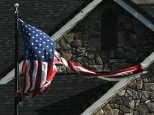
The strongest winds since 2000 ripped through Utah Thursday, the result of high pressure in Wyoming and low pressure in southern California that produced what meteorologists call "down-slope" winds.
Gale-force winds were widespread, with gusts that were clocked at more than 100 mph in Davis County in the north and 90 mph in Washington County to the south.
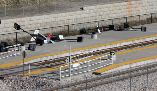
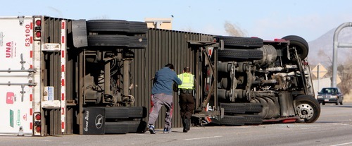
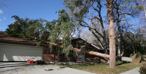
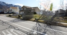
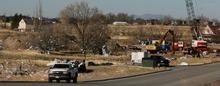
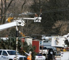
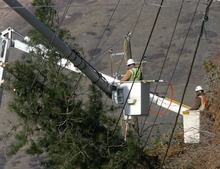
The cold winds pouring westward over the Wasatch Mountains flipped semis, uprooted trees, ripped up roofs and downed power lines in Weber, Davis and Salt Lake counties.
The east-to-west wind storm was caused by a cold air mass coupled with a high-pressure system in Wyoming and low pressure in southern California and Nevada, said Larry Dunn, meteorologist in charge at the National Weather Service's Salt Lake City office. The unusual pressure imbalance set up cold winds that were channeled from the high pressure to the low.
He compared it to water going over a dam. In this case, the Wasatch Mountains served as the dam.
"The cold air is like water going over the top of a dam in a big sheet and it comes crashing in a big wave at the bottom," he said. "It's at the bottom of the dam where the winds are most pronounced. In this case, that's the Wasatch Front."
The winds were fiercest in places where the mountain range is relatively narrow, Dunn said, such as Centerville, where gusts hit 102 mph. By contrast, in places like Sandy, where the mountains are higher and wider, the winds are less strong during such down-slope wind events.
Weber and Davis counties were particularly hard hit, according to the weather service, where wind gusts above 60 mph were not uncommon.
Utah sees down-slope winds from time to time, but they are usually relegated to canyon mouths along the Wasatch Front, Dunn said.
But the cold air mass in Wyoming associated with Thursday's weather was so large, and the winds accompanying it so strong, that the ensuing wind event covered the entire region, including high gusts and damage as far away as southern California. Winds there left 340,000 homes without power Wednesday night and Thursday, according to the Los Angeles Times. In Las Vegas, 5,000 customers were without power following 60 mph wind gusts Wednesday, according to the Las Vegas Sun.
"This is a huge [differential] of high pressure and low pressure. It's a gigantic weather pattern," Dunn said. "The last big ones like this, we had one in 1999 and one in 2000."
Northern Utah saw little precipitation from the weather system. But central and southern Utah got snow that was expected to fall through midday Friday, Dunn said.
"Southern Utah is getting hit pretty hard," he said. "We expect one to two feet in the southern mountains."
The next storm system is expected to move into northern Utah late Friday and early Saturday, according to the weather service. It will bring cold temperatures but is not expected to produce much precipitation.
Highs in northern Utah valleys should be about 36 degrees under partly sunny skies Friday. By Friday night, however, northern valleys will see a 30 percent chance of snow with lows in the mid 20s, according to the weather service. Saturday will bring a 20 percent chance of snow with a high of about 37 degrees.
Blowin' in the wind
Here are peak wind gusts reported by the National Weather Service for various communities on Thursday:
Centerville, 9 a.m. • 102 mph
West Bountiful, 8 a.m. • 92 mph
Bountiful, 6 a.m. • 78 mph
Hill Air Force Base, 8 a.m. • 69 mph
Kaysville, 8 a.m. • 65 mph
Parleys Canyon mouth, 7 a.m. • 63 mph
Carbon County Airport, 7 a.m. • 62 mph
Olympus Hills, 7 a.m. • 65 mph