This is an archived article that was published on sltrib.com in 2012, and information in the article may be outdated. It is provided only for personal research purposes and may not be reprinted.
Coming in time for summer: a Jordan River Parkway Trail map that anyone can use.
The National Park Service has awarded the Jordan River Commission and Salt Lake County a grant to help create a map for users of the 45-mile trail linking Utah, Salt Lake and Davis counties. The project marks the first time in the trail's 30-year history that there will be a map hikers and other trail users can use.
"My mother-in-law asks where can she park her car when she goes to ride her bike [on the trail] with her girlfriends," said Laura Hanson, executive director of the Jordan River Commission. "With the new map, she can see where she can go."
Hanson said the map should be ready — in both printed and online formats — by late spring or early summer.
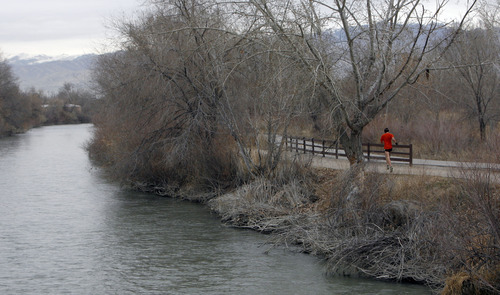
The Jordan River Parkway Trail roughly follows the course of the Jordan River as it leaves Utah Lake and heads north to the Great Salt Lake. The overall plan is to have the trail link up with the Legacy and Denver Rio Grande Western Trail systems, resulting in 76 miles of trails along the Wasatch Front that walkers, cyclists and others can use.
For now, 45 miles of the Jordan River trail are complete, with gaps at Bluffdale, Midvale and Salt Lake City.
The trail was conceived in the 1970s, with the first segment completed in 1981. But navigating the trail has proven to be a challenge, especially for those not fully familiar with it.
Previously, the only trail maps were contained within the master plan. Hanson said those maps were highly technical and didn't readily provide hikers and others the information they needed to get to the trail and plan activities.
That lack of information, Hanson said, creates a barrier for some people who might want to use the trail.
She said Salt Lake City has tried to address the issue, creating a Google Map of the trail.
The new map, Hanson said, will show trail heads, parking areas and restrooms. It will also tell people how to get around the remaining gaps in the trail.
But Hanson sees the map as more than just a document to show people where they are and where they might want to go. She also sees it as an educational tool.
Among the items to be included are sections about water quality, plants people may encounter on the trail and trail etiquette.
"We're trying to make it more of an interpretive element," Hanson said.
The grant does not provide money for the project. Instead, the National Park Service's Rivers, Trails and Conservation Assistance program (RTCA) is providing a consultant to help generate and design the map.
Hanson said the commission and the Salt Lake County Parks and Recreation Division will take care of the printing.
Marcy DeMillion, the RTCA's community coordinator, said the assistance is worth about $5,000 and is part of a larger effort to complete the trail system.
For instance, she said, the park service is working with West Jordan to help complete its section of the trail. That section, DeMillion said, will also provide a connection to the TRAX station at Gardner Village. She said that will be the first trail connection to the mass transit system.
dmeyers@sltrib.comTwitter: @donaldwmeyers —
On the web
Jordan River Commission: http://www.jordanrivercommission.com.


