


This is an archived article that was published on sltrib.com in 2012, and information in the article may be outdated. It is provided only for personal research purposes and may not be reprinted.
There's something about summertime and water. Who doesn't love playing in or sitting around a pool, river, ocean or… a lake?
In Utah, you can combine your lake lounging with a good mountain hike. Here are 10 Utah trails, in no particular order, leading to a high-altitude lake. Where swimming is allowed, do so at your own risk.
Red Pine Lake — Little Cottonwood Canyon
This trail comes with a great view of the Salt Lake Valley. Enjoy crystal clear waters in this lake.
Round trip • 6.2 miles
Elevation change • 2,010 feet
Difficulty • Moderate
Directions to trailhead • Drive 4.6 miles up Little Cottonwood Canyon and take a right for the White Pine trailhead and parking lot.
Island Lake — Uinta Mountains
We could make a whole list out of mountain lakes in the Uinta Mountains. We'll pick this one because it's not so crowded. Changing leaves also makes this a good fall hike. The path is rocky, but there's little elevation change from the trail head.
Round trip • 6 miles
Elevation change • 332 feet
Difficulty • Moderate
Directions to trailhead • From Kamas, take U-150 east for 32 miles to the Crystal Lake trailhead. The trail for Long Lake and Island Lake begins here.
Oowah Lake — Moab
Yes, there is a road leading to Oowah Lake, but why drive there? The Boren Mesa Trail takes you through an aspen forest in the La Sal Mountains to reach the lake.
Round trip • 5.6 miles
Elevation gain • 623 feet
Difficulty • Easy
Directions to trailhead • From Moab, take U.S. Highway 191 south about 7 miles and turn east at the signs for Kens Lake. Drive past the lake about 0.6 miles and turn right onto La Sal Mountain Loop Road. Follow it up the mountain 11.5 miles and bear right at a "Y" intersection marked as Forest Road 071. Take that road about 21/2 miles. The trailhead will be on your left.
Forest Lake — American Fork Canyon
This lake, with its muddy waters, is not a recreation spot where you want to fish or swim, but it sits in the middle of a tree-lined basin that is green in the summer and changes colors in the fall.
Round trip • 3.8 miles
Elevation change • 997 feet
Difficulty • Easy
Directions to trailhead • From Interstate 15, take State Road 92 into American Fork Canyon. Go to Tibble Fork Reservoir and find the right fork, an unpaved road. Follow it for 4.2 miles. The road has exposed rock, wash outs and will be slow traveling. A high-clearance vehicle is preferable. The trailhead is Shaffer Fork, which also is labeled as "FS 194."
White Pine Lake — Logan Canyon
When the wildflowers are blooming this is one of the most beautiful hikes in Utah. If wildflower season is over, the hike through the pines, aspens and a gurgling brook with views of mountain peaks will have to suffice until you reach the lake.
Round trip • 7 miles
Elevation change • 756 feet
Difficulty • Moderate
Directions to trailhead • Follow U.S. 89 out of Logan. Go past Utah State University and into the canyon. From the ranger station at the mouth of the canyon, travel about 20 miles and turn left at the Tony Grove turnoff. Make another quick left and drive up the hill about 7 miles. Park at the paved trailhead.
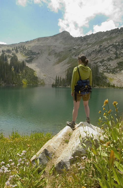
Not to be confused with a lake of the same name in Big Cottonwood Canyon, granite mountain walls, lush vegetation and waterfalls are the landscape that leads to Silver Lake in American Fork Canyon. The trail begins at the already picturesque Silver Lake Reservoir and climbs a dirt trail peppered with boulders.
Round trip • 4 miles
Elevation change • 1,413 feet
Difficulty • Moderate
Directions to trailhead • Take State Road 92 east to the mouth of American Fork Canyon in Utah County. After the fee shack, follow the road for about 5 miles and turn left at junction 144 toward North Fork. Go about 2 miles and pass Tibble Fork Reserve. Stay on the paved road for about another mile until you see a sign on the right for Silver Lake Reservoir. Travel the dirt road for about 4 miles to the parking lot.
Lake Blanche — Big Cottonwood Canyon
Sitting below Sundial Peak, Lake Blanche is the attraction, but the trail also has the smaller Florence and Lillian lakes.
Round trip • 6.5 miles
Elevation change • 2,650 feet
Difficulty • Moderate
Directions to trailhead • Drive 4.5 miles up Big Cottonwood Canyon and park in the Mill B South Trailhead parking lot. The Lake Blanche Trail starts on the paved road near the restrooms.
Deer Creek Lake — Boulder Mountain
There's more than red rocks and desert in southern Utah. The trail to Deer Creek Lake is lined by green grass and aspen trees. Look for deer and elk on the trail and ducks on the lake.
Round trip • 6 miles
Elevation change • 678
Difficulty • Moderate
Directions to trailhead • From Torrey, drive west on Highway 12 for 26 miles. From the town of Boulder, drive east on Highway 12 for 9 miles. The trail head will be on the west side of the road.
South Willow Lake — Tooele County
Yes, even in Utah's west desert you can find a mountain lake. In that respect, South Willow Lake is truly an oasis, albeit one that requires a 1,630-foot trek off the desert floor.
Round trip • 7 miles
Elevation change • 1,630 feet
Difficulty • Moderate
Directions to trailhead • On Main Street in Grantsville, turn south on 400 West. Drive 6 miles to the South Willow Canyon Road exit. It's about 8 miles to the Loop Campground where the trailhead is located.
Five lakes loop at Brighton — Big Cottonwood Canyon
The granddaddy of the list. Do yourself a favor and take all day to hike this trail and enjoy Lake Catherine, Lake Martha, Lake Mary, Twin Lakes and Silver Lake (the Big Cottonwood Canyon version).
Round trip • 6.7 miles
Elevation change • 1,205 feet
Difficulty • Moderate
Directions to trailhead • Drive to the top of Big Cottonwood Canyon and park at the Silver Lake Visitor Center at Brighton. Start hiking on the south side of the boardwalk heading southwest.
— Nate Carlisle
Twitter: @UtahHikes