This is an archived article that was published on sltrib.com in 2017, and information in the article may be outdated. It is provided only for personal research purposes and may not be reprinted.
The final route of the West Davis Corridor — a 19-mile freeway heading northwest from Legacy Parkway through Davis and Weber counties — will closely mirror the initial course proposed in 2013 that created years of delay and protest.
But state transportation leaders say they made numerous concessions after opposition from the U.S. Army Corps of Engineers and conservation groups that worried it would destroy too many Great Salt Lake wetlands, grass-roots groups that feared it would demolish their homes and transportation groups that said other options made more sense.
For example, officials propose a new 1,100-acre wetland and wildlife mitigation plan — including buying up private land now within existing preserves.
Like Legacy Parkway, the new freeway would have noise-reducing pavement; lighting only at interchanges, specially designed to preserve dark skies and not interfere with nocturnal wildlife; 20 miles of trails; two lanes in each direction; and mostly ground-level construction so the road is not elevated.
Unlike Legacy, the West Davis Corridor would allow semitrucks, would have a speed limit of 65 mph instead of 55 mph and would allow billboards (although cities in the area would have the option of banning them).
"So we don't consider it a true parkway like Legacy Parkway," said Randy Jefferies, manager of the project for the Utah Department of Transportation. "We know that this affects thousands of lives. We've taken the extra time to be thorough and to respond to concerns because we want to get this right."
UDOT released a final environmental impact statement (EIS) on Thursday — four years later than originally planned — after the agency took time to work through initial opposition and pleas to consider alternatives. It will take comment through the end of August on the study. A final record of decision is expected in the fall.
The final EIS is 3,000 pages long, 8 inches high, and is printed in six volumes.
Changes in the initial plan, plus inflation during the years of delays, has now raised the estimated cost of the project from $600 million to $725 million.
Even before the final route was announced, the Utah Transportation Commission voted in May to use part of $1 billion the Legislature approved to borrow through bonding over the next four years to help pay for that project. Construction of the first $610 million phase from Farmington to Antelope Drive is expected to begin in 2020.
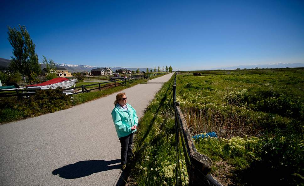
The new freeway would connect with both Legacy Parkway and Interstate 15 at Glovers Lane in Farmington, and end at 1800 North at 4000 West in West Point.
UDOT estimates that route would force relocation of at least 25 homes, and perhaps nine more. It would also displace at least four businesses, and perhaps as many as nine.
Some residents who would lose homes around Glovers Lane had pushed for the route to begin farther north at Shepard Lane. Jefferies said the Shepard Lane option "did not meet federal safety and operations standards because it was too close to the U.S. 89-Legacy/I-15 interchange."
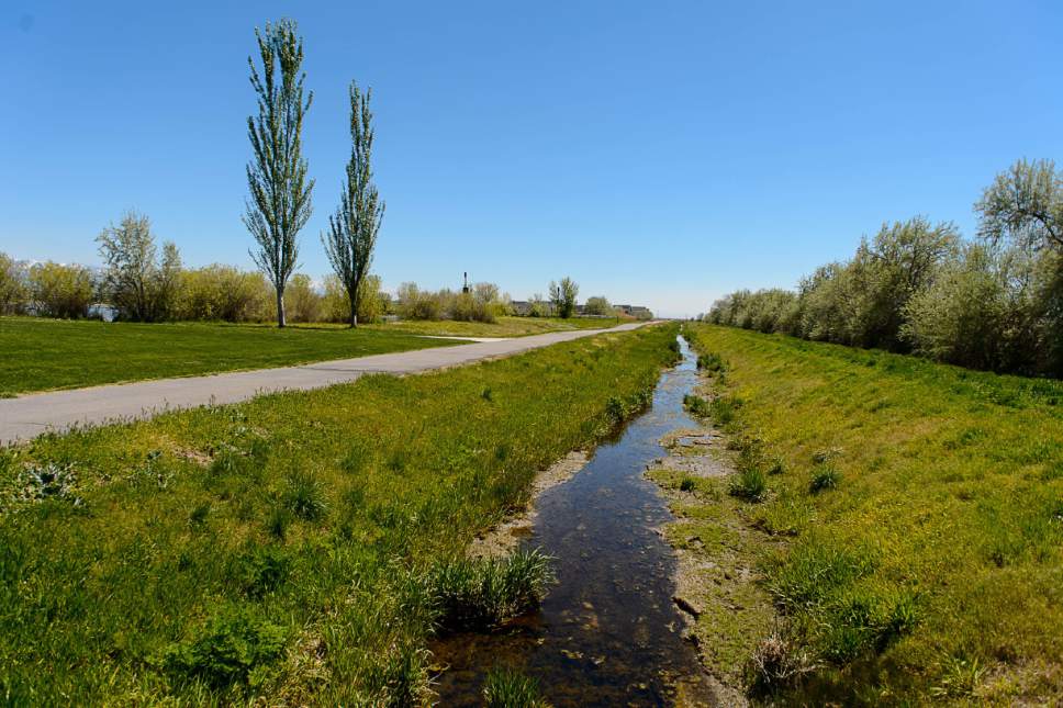
The freeway now is expected to directly impact 64 acres of the Great Salt Lake Shorelands Preserve, only 14 of which are considered high quality.
Jefferies said UDOT worked with the Corps of Engineers and environmental groups about how mitigation might help preserve wetlands that they feared the freeway would destroy.
"The idea was proposed to purchase some of the private ground that is still within the overall boundary of the preserve to fill in the gaps so that we have a contiguous preserve," he said. That includes buying some land by Farmington Bay to allow preserve expansion there. The plan developed with conservation agencies involves buying a total of 1,100 acres.
Jefferies said the freeway is expected to reduce traffic congestion west of I-15 by a third by 2040, compared with what traffic would be there without it.
Unlike Legacy, the new freeway would allow large trucks. But, "We expect a very low volume of trucks in this corridor. The trucks are those that would be serving western Davis communities. We would prefer that those trucks be on this corridor" rather than smaller roads there, Jefferies said.
Roger Borgenicht, co-chairman of Utahns for Better Transportation and a leader of groups critical of the freeway, said he is pleased about many of the improvements UDOT is proposing, but is disappointed it is still proceeding with a freeway.
"It is a mistake to build this highway," he said. "I think building more highways, dividing communities will negatively impact the quality of life."
He pushed an alternative — called the Shared Solution — to avoid the need for a freeway with such things as upgrading existing east-west streets into more efficient boulevards, adding connected bikeways and improving transit and land use to create compact neighborhoods where residents would not need to commute.
UDOT studied this alternative approach for a year and a half, but ultimately rejected it, saying it did not reduce congestion enough. But Jefferies said many of the improvements in the plan incorporate proposals from the Shared Solution.
Borgenicht complained that UDOT and federal rules give highest priority to allowing automobile traffic to travel at the highest speed, not to preventing traffic — so a freeway becomes the favored solution.
"They are trying to accommodate the prediction that the total miles we drive each day will continue to go up," Borgenicht said. "That's what causes congestion and delay."
In a meeting with stakeholders to explain UDOT decisions Thursday, cities, counties, federal agencies and environmental groups asked plenty of questions — but had few complaints. Most praised the seven-year process for listening to concerns and for making improvements to the project — even if they are not totally happy.
Initial proposals were "a hard pill for us to swallow," said Farmington Mayor Jim Talbot. "We're not completely satisfied with what's happening, but the process has been good" recently, and he applauded improvements added to the plan.
"We weren't excited about a freeway," said Chris Brown, director of stewardship for the Nature Conservancy. "We're not against it either, necessarily. We're just trying to figure out how to make this work for everybody." He also lauded current wetlands mitigation plans.
"We didn't always get what we want," West Point City Manager Kyle Laws said. "But the process has been fair."
Some residents had questioned how serious UDOT was in considering alternatives, noting that during the extended study period it continued to buy property in the proposed corridor — and even put stakes in the ground along part of the route marked "Hwy RxW" for highway right of way.
Some also have expressed concern about the potential profit for two key state lawmakers backing the freeway, House Majority Leader Brad Wilson, R-Kaysville, and Senate Majority Whip Stuart Adams, R-Layton, who are developers with extensive property holdings near the proposed route.
Jefferies said UDOT's seven-year study shows the agency carefully considered all options. He adds that the state routinely buys property to preserve proposed corridors. "We are using some of those properties that were purchased and set aside for the corridor, but we are also not using many of the properties that were set aside." —
How to comment on plan
The final study is available online at udot.utah.gov/westdavis. Comments may be submitted through Aug. 31 in the following ways:
• An online comment form at udot.utah.gov/westdavis.
• Email: westdavis@utah.gov
• Mail: 466 N. 900 West, Kaysville, UT 84037.


