This is an archived article that was published on sltrib.com in 2014, and information in the article may be outdated. It is provided only for personal research purposes and may not be reprinted.
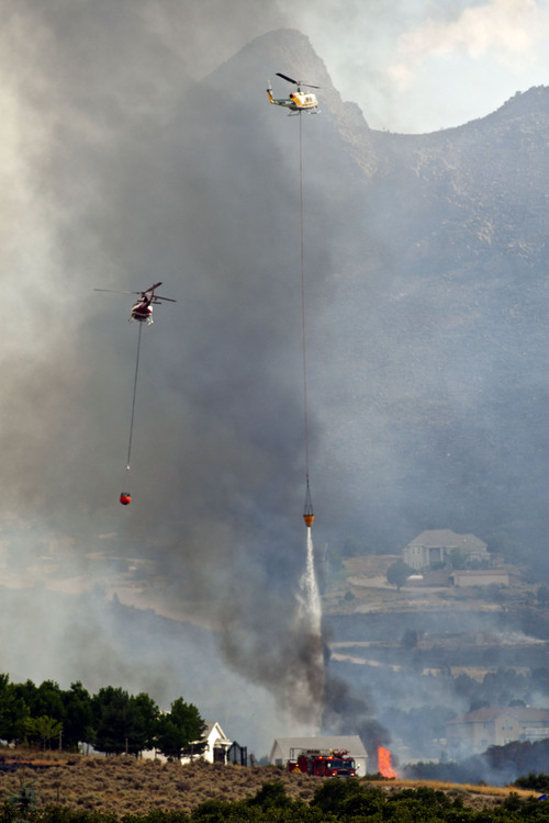
Over the past three decades, wildfires in the western United States have been getting larger and more frequent, according to new research from the University of Utah.
This trend, which U. geographers documented with satellite images, could reflect the increasing temperatures and drought severity associated with climate change, according to lead author Philip Dennison.
Dennison's team examined every fire of at least 1,000 acres from central Nebraska to the Cascades between 1984 and 2011, nearly 7,000 in all. The number of such fires rose by seven per year over the 28 years, and they burned 90,000 more acres a year.
"Fire is really complex. A lot of things contribute to fire in the West," Dennison said.
These findings don't support the notion, popular among many Utah political leaders, that the federal government has done a poor job managing national forests in the past two decades.
This is because the research documented increased fire in all sorts of ecosystems, not just mountain forests where logging has been sharply reduced, Dennison said.
"There has been a lot of fire supression in the past in the mountains and there has been a build up of fuels. This build up could be leading to more fires and larger fires," said Dennison, an associate professor of geography.
"But we are seeing a trend across the region. We are seeing it in deserts and grassland. The fact that we are seeing it in so many different ecosystems tells us something bigger is going on here."
That bigger thing could be climate change driven by greenhouse gas emissions accumulating in the atmosphere because of fossil fuel use. In addition to measuring the number and size of fires, the team looked at seasonal temperatures and precipitation.
The places with the most severe droughts had the biggest increases in fire: western mountain ranges, southwest deserts and grasslands.
Richard Hutton, a University of Montana fire ecologist who did not participate in the study, said Dennison's work offers further proof that increasing severity of wildfire has less to do with fuels than with weather.
But he cautioned that severe fire is a natural process, not a new phenomenon.
"It's always been around. You can dig into the charcoal record in lakebeds and see severe fire has been going for thousands of years," he said. "Why else would you see plants and animals that occur nowhere else except where there is severe fire?"
Dennison's team studied nine of the West's eco-regions, including the Basin and Range, which covers western Utah, and the Rockies, which includes the mountainous spine of Utah. Dennison did not analyze the Colorado Plateau and Wyoming Basin because so little fire occurs there, but used these areas' fire data for the larger regional analysis.
While the Basin and Range sees plenty of fire, the number and size did not increase markedly over the 28 years, Dennison's team found. The Rockies, however, saw an impressive bump, increasing by 1.4 fires a year, reaching 46 and scorching 533,000 acres in 2011. The peak year, however, was 2007 when 93 fires burned on 2.2 million acres.
"There is so much variation from year to year, but we can look at the overall trend and see that fire has been going up quite a bit, Dennison said.
Throughout the West, 2011 saw 507 large fires on 5.4 million acres.
As for the future, Dennison said land management agencies should expect to see greater costs associated with fighting fire, loss of timber and habitat disturbance.
The study, funded by the federal Bureau of Land Management, is to appear next week in Geophysical Research Letters, a journal published by the American Geophysical Union. Authors included U. geographers James Arnold and Simon Brewer and Max Moritz of the University of California, Berkeley.


