

This is an archived article that was published on sltrib.com in 2013, and information in the article may be outdated. It is provided only for personal research purposes and may not be reprinted.
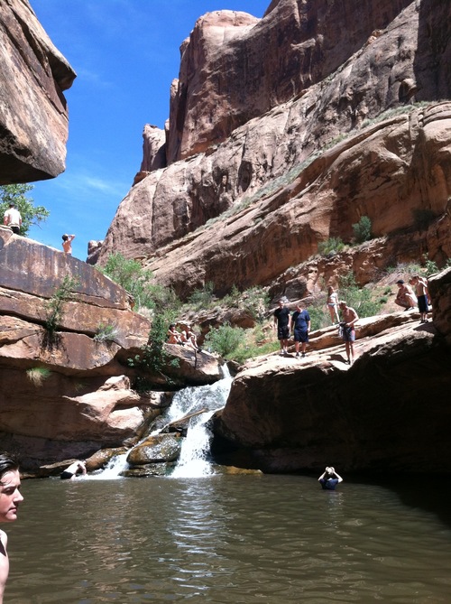
Directions • This hike has it all: River, waterfall, swimming hole and even petroglyphs.
The trailhead is located on the south end of the town of Moab. To get there from southbound U.S. Route 191 (also Moab's Main Street), turn left on 300 South, then right on 400 East. Turn left onto east Mill Creek Drive. Follow the road as it winds out of town, then turn left on East Powerhouse Lane. There's a parking lot near the trailhead, which can get crowded on nice days.
Prepare to get wet on this hike, and wear a swimming suit to take full advantage of the swimming hole at the end. The hike starts on a rocky bank that drops down to the creek, which can be a bit of a challenge for small children. It drops down to a wide, sandy path as the terrain opens to red rock cliffs and lush water plants. Keep and eye out for petroglyphs on the walk, which crosses the creek a couple of times before ending at a small waterfall and swimming hole.
Stay and swim at the bottom or climb up the rocks again for another view of the creek. Destination Mill Creek
Hiking time 1 hour
Round trip miles 2 miles
Elevation gain 374 feet
Difficulty Easy
Trail head restrooms No
Dogs allowed Yes, though could be tough for older dogs
Bikes allowed No