


This is an archived article that was published on sltrib.com in 2015, and information in the article may be outdated. It is provided only for personal research purposes and may not be reprinted.
Not every national park is a hiker's park.
The trail system at Badlands National Park basically consists of one 5-mile path with a loop in the middle.
The first sentence on Death Valley National Park's hiking webpage begins with, "There are few constructed trails here...." Temperatures of 120 degrees may deter hiking, too.
And that's not necessarily the warmest hiking in the National Park Service. The trails at the Hawaii parks are sometimes closed due to lava.
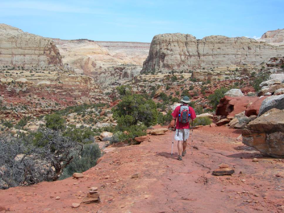
But for a park with day hikes that can suit any walker, look to Capitol Reef National Park.
There are short hikes. There are long hikes; hikes of medium length.
There are trails that gain elevation. There are trails that are flat; some are a little of both.
There's a hike to an arch. There's a hike to a natural bridge. You can hike through a creek.
There are so many hikes, Capitol Reef's webpage features 10 hiking guides, each for different sections of the park. Ten!
Here's a collection of the best of those trails. Click the links to learn more about each hike:
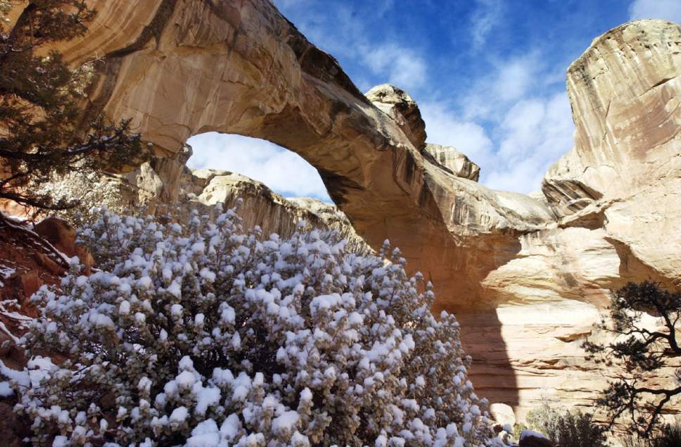
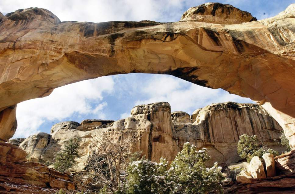
• Hickman Bridge: This is the most-popular hike in Capitol Reef, and for good reason. At just 2-miles round-trip, the hike is easy enough for kids. But the view of a 133-foot natural bridge offers a fine reward for every hiker. The trail itself is fun, too, and includes a walk along the Fremont River.
• Golden Throne: Golden-colored Navajo sandstone around a dome-shaped mountain makes this one of Capitol Reef's most-visible features. The four-mile round-trip gains 730 feet in elevation and has some steep drops. There's also a view of the Henry Mountains.
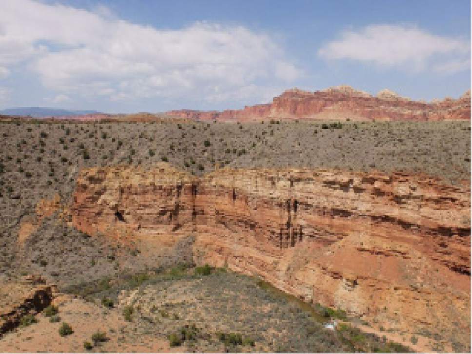
• Rim Overlook Trail and Navajo Knobs: This may provide the best views of any trail in the park. The Rim Overlook Trail provides panoramic views of the green orchards below and the waterpocket fold that defines Capitol Reef's geology. The overlook is 2.3 miles up the trail. Double that distance, and you will reach Navajo Knobs. It's a series of white sandstone spires. Great overlooks continue all the way to Navajo Knobs. If you hike the entire trail, it's 9.2 miles round-trip with 1,670 feet in elevation gain.
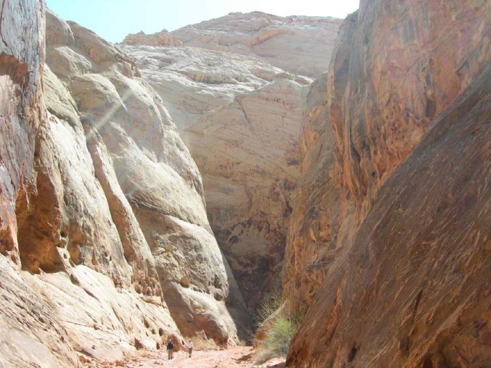
• Cassidy Arch: What's a hiking trip to southern Utah without seeing an arch? This one is so big you can see it from almost a mile away. The trail starts goes over slickrock for a 3.5-mile round-trip and 670 feet in elevation gain. That makes it suitable for most adults, but some steep drops mean it's not a good idea for small children.
• Frying Pan Trail: The southern end of this trail follows the trail to Cassidy Arch. Then the Frying Pan Trail veers west and north, through a canyon painted red, yellow and white, up and down switchbacks, over sand and slickrock all the way to Cohab Canyon. After about 3 miles and 800 feet of elevation gain, you reach State Road 24, where you can park your second vehicle, or — probably — hitch a ride back to your car. Hiking back the way you came might not be so bad, either.
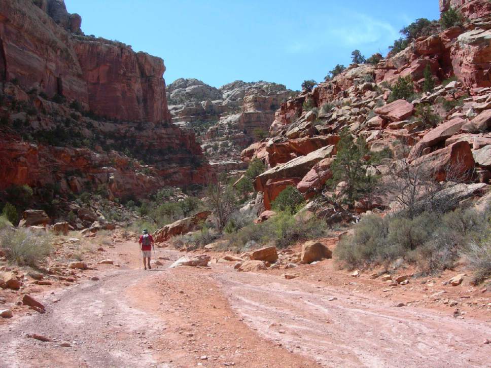
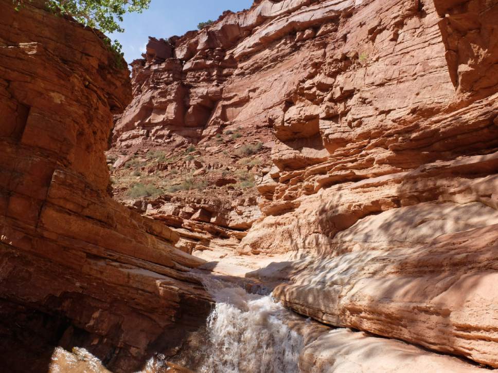
• Sulphur Creek: This one isn't marked on the brochures you receive at the park. But from Capitol Reef's visitor's center, you walk behind the building to Sulphur Creek. Follow the creek downstream for about a mile, and you'll find a 5-foot waterfall. There's almost no elevation change on this hike. Be ready to get your feet wet.
• Fremont River Trail: This one starts you along the river then takes you up for a panoramic view of the canyon the river helped carve. From the trailhead next to the park's amphitheater, a paved path walks you along the river. At about four-tenths of a mile, the trail begins climbing a ridge. At the end is an overlook over the canyon and river below. The round-trip is 1.58 miles with a 415-foot elevation gain.
Twitter: @natecarlisle