


This is an archived article that was published on sltrib.com in 2011, and information in the article may be outdated. It is provided only for personal research purposes and may not be reprinted.
Smog haters take heart — relief is on the way.
By late Saturday, valley haze and pollution should blow away, according to the forecast by the National Weather Service.
A Pacific cold front should push through the state Saturday afternoon or evening, said Larry Dunn, meteorologist-in-charge at the Salt Lake City weather service station.
"We think the gunk will be gone by Sunday morning," he said.
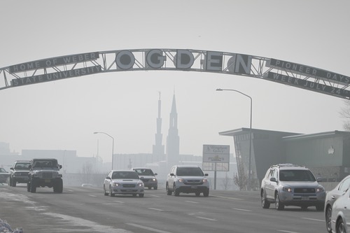
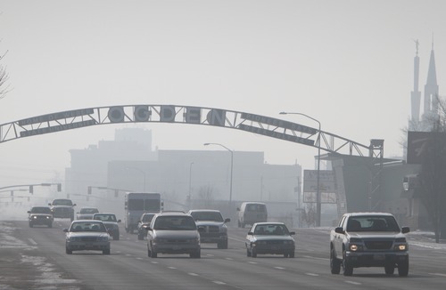
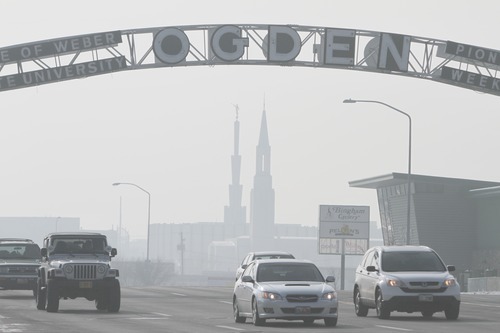
Air quality alerts have been in place in Salt Lake, Davis, Weber, Box Elder and Cache counties for several days because of unhealthy levels of pollutants in the air.
On Thursday, Salt Lake City International Airport experienced periodic flight diversions and departure delays due to freezing fog.
Airport spokeswoman Barbara Gann said the fog, obscuring visibility at ground level Thursday morning, forced more than a dozen inbound flights to divert to other regional airports between 8:30 a.m. and 9 a.m.
By midafternoon, 15 flights were delayed in departing Salt Lake City. Some delays were only 20 minutes or so but several flights experienced waits of more than an hour. Low visibility from 5:40 to 8 p.m. caused delays of between 15 minutes and two hours, Gann said.
Saturday's front won't pack much moisture. It could drop several inches of snow in the mountains, but valley locations should get only an inch, according to the forecast.
Areas of fog will persist in Salt Lake and Tooele valleys on Friday. Highs will be in the mid 20s with lows about 15.
Snow is expected Saturday afternoon with highs in the mid-30s. Lows near 20 are forecast for early Sunday with mostly cloudy conditions the remainder of the day. Sunday's forecast high is for temperatures in the upper 20s.
Cache County also can expect snow late Saturday. Lows early Sunday will be 5 to 10 above zero. Mostly cloudy conditions will prevail through Sunday and Monday.
Hanksville and Moab, in southeast Utah, most likely won't see any precipitation, according to the forecast. Saturday should be partly cloudy with highs in the upper 30s. Lows will be near 15 Sunday morning under partly cloudy skies.
In southwest Utah, St. George will be partly cloudy Saturday with highs in the upper 40s. Early Sunday lows are predicted to be in the low 30s. Sunday is forecast for partly cloudy skies, according to the weather service."
csmart@sltrib.com Bob Mims and Roxana Orellana contributed to this story.