


This is an archived article that was published on sltrib.com in 2011, and information in the article may be outdated. It is provided only for personal research purposes and may not be reprinted.
Directions • From Moab, travel seven miles south of the city on U.S. 191 until you reach the turnoff on the east side of the road marked for Ken's Lake. Follow the sign three more miles to the campground and park.
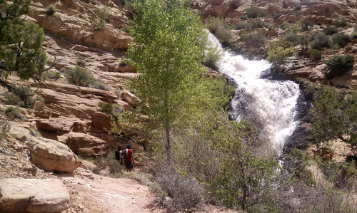
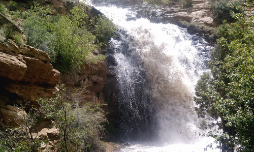
The trail to Faux Falls starts in several places near Ken's Lake Campground. Some starting points force you to cross a stream and get wet up to your knees. The official beginning is between campsites 18 and 19, where there is a bridge over the stream. The first part of the red dirt path is lined by rocks on each side. It goes east and mostly follows the stream that feeds Ken's Lake. The trail is well marked with little elevation except for a few rolling hills and a section or two of slickrock to walk up. After half a mile, the trail is no longer marked by rocks. It crosses a dry wash and heads up to the falls. The falls can be seen along the whole path. It was gushing over Memorial Day weekend. Most of the hike lacks shade, so bring a hat and water. —
Trail essentials
Destination • Waterfall
Round trip miles • 2 miles
Hiking time • One hour
Elevation gain • 154 feet
Difficulty • Easy
Dogs allowed • Yes
Trailhead restrooms • Yes
Fee • No