

This is an archived article that was published on sltrib.com in 2012, and information in the article may be outdated. It is provided only for personal research purposes and may not be reprinted.
Utah's weather on New Year's Day, like the holiday, will be a test of perspective. Either it heralds a fresh start — or more foggy, polluted and bone-chilling cold oblivious to the calendar.
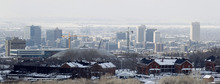
Unfortunately, the Wasatch Front forecast through New Year's Day calls for overnight lows ranging in the low-teens to well below zero, light snowfall and deteriorating air quality.
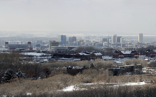
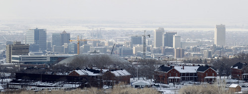
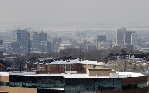
So don't breathe too deeply: The Utah Division of Air Quality (DAQ) issued a warning for unhealthy air for Salt Lake, Davis, Weber, Cache and Utah counties due to elevated particulate and ozone levels. Box Elder and Tooele counties earned "yellow," or compromised air quality ratings, while Duchesne was the sole "green," or healthy air grade recipient.
Gauging how good, or bad Utah's air quality performance has been compared to this time a year ago is a tricky proposition. While DAQ provides color-coded ratings to begin each day, those often change — even hourly — along with conditions. Also, the meaning of "Red" has changed somewhat: DAQ now issues its most serious air quality warning for days when particulate pollution approaches 25 microns per cubic meter of air, whereas this time last year, a "Red" alert was not issued until the federal standard of 35 mpcm was reached.
However, DAQ spokeswoman Donna Spangler did note Monday that for the entire monitoring season of October 2011-March 2012, the Salt Lake/Davis monitoring district had just two mandatory "no burn" days — a number already matched halfway through the current October 2012-March 2013 season.
How long is the bad air quality expected to stick around? According to the National Weather Service, stagnant conditions may persist at least through Friday, along temperatures will slow rise during that time.
Among the coldest temperatures forecast for early New Year's Day are Bryce Canyon at 13 below zero; Randolph at minus 8; Bear River and Duchesne, minus 6; Richfield, minus 3; Delta, minus 2; and Logan, minus 1.
Salt Lake City expects a low of 12 degrees on Tuesday with the day's high rising to just 26 degrees, the same as Monday's forecast; Ogden should see highs of 24 both days, sandwiching a low of 10; Provo was to follow a low of 11 with a high of 26, a degree cooler than Monday's high; Logan's sub-zero low preceded a high of 17, a degree warmer than Monday; Wendover looked for 5, 21 and 23, respectively; Duchesne's high on Tuesday was pegged at 14, down from Monday's 15; Cedar City, with a low of 2 expected a New Year's Day high of 25, up from Monday's 24; St. George looked for a 23-degree low and a 42-degree high on Tuesday, mirroring Monday's mark; and Moab, a chilly 9 overnight, looked for 22 degrees on New Year's Day, 3 degrees cooler than Monday's reading.
The Utah Avalanche Center rated the state's mountain slopes at "moderate" risk for dangerous snowslides, with the exception of the "considerable" grade it gave to central Utah's Skyline district.
So, back to that perspective thing about the New Year. What would be the optimistic view? The election, along with its flood of negative campaign ads, is over and we did survive the Mayan Apocalypse.
Happy New Year!
Red Alert: What does it mean?
On "Red" air quality alert days, people with existing heart or respiratory ailments should reduce physical exertion and outdoor activity during the mid-morning and afternoon hours. Wood/coal stoves or fireplaces must not be used. Vehicle use should be reduced by consolidating trips. Industry should optimize operating conditions to minimize air pollution emissions.
Source • Utah Division of Air Quality