


This is an archived article that was published on sltrib.com in 2013, and information in the article may be outdated. It is provided only for personal research purposes and may not be reprinted.
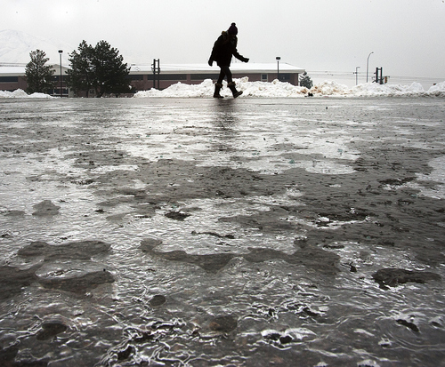
From freezing rain to filthy air, snow-clogged streets to frigid temps, January was a veritable buffet of wintry weather. It was memorable, certainly, although many Wasatch Front residents might prefer to forget it.
"It was definitely a weird month," said Christine Kruse, a forecaster with the National Weather Service's (NWS) Salt Lake City office.
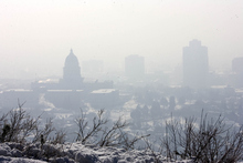
That weirdness included only the 10th freezing rain storm since 1928, and the fifth-coldest and 13th snowiest January since 1874 at the NWS weather station at Salt Lake City International Airport. After 37 straight days of an inch of snow on the ground at the airport, and 22 days of mandatory action air alerts, January's end left snow removal services grinning, asthma sufferers gasping and most folks shivering.
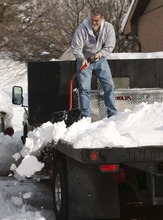
"We had more sales this January alone than previous entire seasons," said Nephi Robinson of Robinson Snow Removal in Salt Lake City, whose company has been in business five years. "It was a good January as far as the snow removal business, but for sure the most demanding. ... It's been hard on our equipment. It's been difficult to keep our equipment running at times because of the pressure."
Another January weather oddity: Several "upside down" storms left more snow in valleys than mountains. That means snowpack in much of northern Utah's mountains is lower than normal. Kruse said Ben Lomond Peak is at 62 percent of normal, Brighton is 76 percent, Parleys Summit is 97 percent and Snowbird is 90 percent.
That's a bit of a concern for Randy Julander, snow supervisor for the Natural Resources Conservation Service. In terms of water content, January began and ended with some good storms but nothing in between.
"We started out January at average and above for snowpacks in the mountains," said the veteran water watcher. "But we are ending up January anywhere between 10 to 15 percent down from where we were Jan. 1. Even though people have shoveled snow, are sick of shoveling and don't want to shovel any more, we got more snow proportionately down [in the valley] than up high. That means we want more snow. There is no other way to put it."
Liberty resident Marc Zabo, who found 28 inches of snow in his yard from the storm earlier this week, agreed there was little to the powdery stuff.
"It's easy to blow off and get rid of," he said "About three years ago, we had a ton of snow and it was really bad. But last year was really weak. We had grass [in 2012] this time of year."
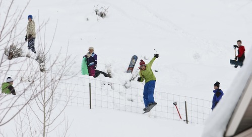
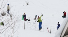
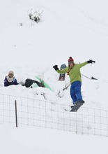
Moisture content wasn't a concern for people who played in the snow, however.
"In about 50 years, I'm going to be telling my grandkids about this storm," said Jodie Stackhouse, who snowboarded Tuesday morning at Snowbird. "I could really use a snorkel out there."
On Thursday, Snowbird reported that more than 3 feet of snow had fallen at the resort since Sunday, for a total of 222 inches so far this season.
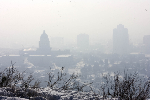
But January's long-lasting inversions were difficult for people with lung issues.
"I definitely noticed a lot of trouble breathing," said Kruse, who has been diagnosed with asthma. "A lot of people are having a little bit of trouble."
Bo Call, who manages air monitoring for the Utah Division of Air Quality, said the 22 red alert days in the Salt Lake Valley were closer to normal than many might expect.
"We have short memories," he said. "We think the last year was normal, but we didn't have many [inversions] last year. It was not as cold…so it was not really normal. It's closer to normal [this year], though the inversions were rather long."
Kruse said February should be less severe. Based on averages, three of the five coldest months on record in Salt Lake City were January, with one in December and one in February.
Still, inversions are likely in early February, she said.
"We will probably get an inversion again," said Kruse. "But we are getting past the climatological point where we have superstrong inversions where we trap that much haze in the valley. By Feb. 14, the sun angle is too high to allow those strong inversions. It is harder to develop [them] when you have a longer period of daytime."
Twitter @tribtomwharton —
January weather highlights
18.8 • Average temperature, 10.6 degrees below normal
No. 5 • Fifth coldest January in Salt Lake City since 1874
37 • Straight days of an inch or more of snow on ground at Salt Lake airport
23.8 • Inches of snowfall at airport, 13th snowiest since 1874
22 • Red alert air quality days in the Salt Lake Valley.
Upcoming in February
34.2 • Average normal temperature
10.7 • Average inches of snowfall at airport
Sources: National Weather Service Salt Lake City Office, Utah Department of Air Quality