


This is an archived article that was published on sltrib.com in 2013, and information in the article may be outdated. It is provided only for personal research purposes and may not be reprinted.
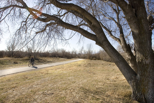
Part of my job involves driving through the cities of Salt Lake and Davis counties seeking story ideas. Whether driving a car, riding TRAX, walking or even hopping on my bicycle, what I have noticed is that the number of paved trails seems to be growing.
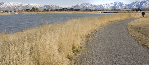
There are major systems, such as the nearly completed Jordan River Parkway, and small convenient trails, such as the 2.5 miles of paved trails that the developer of my Taylorsville subdivision had the foresight to build.
There are trails in Draper, in Herriman subdivisions, around Decker Lake, near the American Express Building, in Sandy, throughout Davis County and along the West Valley City TRAX line, to name just a few. The Bonneville Shoreline Trail is slowly but surely being constructed, as is the Parleys Trail. The latter will be helped from funding by the recently passed Salt Lake County Recreation Bond.
The problem is finding where some of these trails, bike lanes and trailheads are and how they might connect. This is especially true for those who might consider bicycle commuting.
I searched the Internet and found some sites for Salt Lake County and its cities. The best was http://www.cancerutah.org. But you had to click each city, and if you wanted to commute from, say, Sandy to Salt Lake, on your bicycle, it would be difficult to find a route.
George Deneris, the active transportation coordinator for Salt Lake County, sent me to the Wasatch Front Regional Council website at http://www.wfrc.org. After some searching, I found a map with different types of trails along the Wasatch Front. While it might be good for planners, its scale was such that it had little if any value to actual trail users.
Deneris said the ultimate vision is to have a regional map of facilities that could be accessed on a smartphone application. Users would input where they wanted to travel to from Point A to Point B and get an answer quickly.
"Bike commuting is just not there," he said. "Users don't feel they have the ability to ride some of the busier roads vs. some of the less busy roads. We've thought about several different approaches, including a stress-level test that would try to match their abilities with the stress capability they are comfortable with using. It would take a couple of years to get fully developed and it would be a living entity, with updated information."
Salt Lake County is hindered by the fact that its last trails master plan was completed 22 years ago and is hopelessly outdated.
But Walt Gilmore, the landscape architect, park planner and Parleys Trail project manager for Salt Lake County, offered two helpful publications.
The first is a Jordan River Parkway Trail Map, a useful publication that shows the main trail, spur trails, equestrian trails, bike routes to transit, mileage between points and bike routes to mass transit such as TRAX and FrontRunner. Gilmore said he expects the last four gaps in this trail to be completed within four years, offering a single trail stretching from Utah to Davis County.
The second publication is a single sheet of paper showing where the Parleys Trail will eventually join the east bench with the Jordan River. Only a small part of the dream is in place at the mouth of Parleys Canyon near Tanner Park. But Gilmore said there is money to finish four more segments, including from 800 West to 300 West up and over the Roper Yard to be completed in two years, State Street to 500 East to be done by July, 500 East to Hidden Hollow and Sugar House Park from 1300 to 1700 East. The latter two should be complete by the end of the year. And bids are going out for the tunnel under 1300 East.
Progress is also being made in Olympus Cove for the more primitive Bonneville Shoreline Trail.
Since recent Salt Lake County surveys have revealed that residents want even more trails, the progress being made is encouraging.
But what would be even more helpful would be a countywide map of all the available trails and bike routes and a new master plan.
Twitter: @tribtomwharton